Raising Water Consciousness through
World’s Biggest Photo Exhibition and
Largest collection of Photo Stories on Water
Photo Stories | Water and Culture
Living Below the Sea Level: An Adaptation to Water Abundance in Kuttanad, Kerala
Nandita Singh and Om Prakash Singh
15 November, 2018
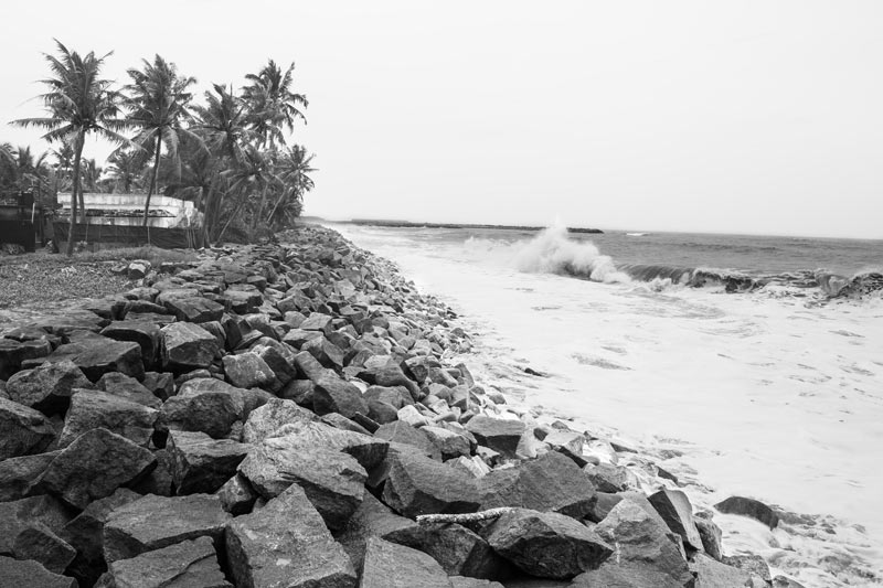
The State of Kerala is richly endowed with wetlands, constituted of vast networks of lakes, rivers and canals. Kuttanad wetland, the region of lowest altitude in India, is part of the largest wetland complex and Ramsar site in India - the Vembanad-Kol ecosystem. With nearly two-thirds of its approximately 900 sq.km. area located 0.6 - 2.2 m below mean sea level, it is the combined deltaic floodplain of Pamba, Achencoil, Manimala and Meenachil rivers. These rivers criss-cross Kuttanad through an intricate network of canals, rivulets and waterways to confluence in the adjoining Vembanad Lake before joining the Arabian Sea. Kuttanad receives a high average annual rainfall of more than 3,000 mm, with more than 60% during the monsoon season. This makes the riverine network get flooded, in turn causing large areas to remain waterlogged for a considerable period of the year, particularly due to its location below the sea level. As a result, the entire region is characterized by water abundance with little naturally-available land mass, making it an unfavorable habitat and posing formidable challenge to stable human colonization. However, human ingenuity has transformed this hostile landscape into one of fortune through meticulous engineering of the vast unfriendly waterscapes, utilizing these for maximal human benefit in a unique manner. Today the region comprises 79 revenue villages distributed across three districts of Kerala, namely, Alappuzha, Kottayam and Pathanamthitta, with 57%, 36% % and 7% areas respectively. The more than two million inhabitants of the region share an intimate relationship with the water abundance around and their habitations, daily chores, food, festivals, sports, transport, livelihoods and almost every aspect of socio-cultural life are derived from and revolve around this unique relationship. This photo story aims to throw light on the different dimensions of the unique form of human-nature-water relationship in Kuttanad, Kerala that enables human populations to survive and thrive amidst water abundance below the sea level. The title photo depicts the Arabian Sea and a human habitation on the coast in Alappuzha district, Kerala.
The Vembanad Lake in Alappuzha district, Kerala
The Kuttanad wetland lies to the south and east of the Vembanad Lake, which is the longest lake in India and the largest one in Kerala, with a distance of 96 km from Kochi in the north to Alappuzha in the south with a northwest–southeast orientation. A considerable part of the lake bed lies below sea level, with an average depth of 1.7 m below mean sea level. It is spread across three central districts of Kerala, viz, Ernakulam in the north, Kottayam in the east and Alappuzha in the south and covers an area of 241 sq.km. In this lake, which receives saline water from the Arabian Sea, the rivers Pamba, Achencoil, Manimala and Meenachil discharge their freshwater after traversing through the Kuttanad floodplains. The lake has played an important role in the development of the unique human-water relationship in Kuttanad. Its shallow stretches have provided the opportunity for land reclamation for human settlement, with about one-third of its water cover (approx. 80 sq km) having been reclaimed.
River Pamba - the major river emptying into Vembanad Lake in Alappuzha district, Kerala
Pamba River, shown in the photo above, is the third longest river of Kerala with a course of over 176 km, enriching lands in Alappuzha, Kottayam and Pathanamthitta districts. In the deltaic floodplains of Kuttanad, it exists together with the other 3 rivers - Achencoil, Manimala and Meenachil - as an intricate network of canals, rivulets and waterways that are so closely blended that it is difficult to identify individual rivers. The network, estimated to be 240 km long and finally discharging into the Vembanad Lake, brings water, rich sediments and other aquatic wealth to the inhabitants of the region. According to Hindu Epics, Pamba was Lord Brahma's daughter, who was later married to Lord Shiva. The river is also known as 'Dakshina Ganga' or 'Ganges of the South', and bathing in the river is believed to absolve one's sins. At several places in the deltaic floodplain of Kuttanad, embankments have been created along Pamba and other rivers and their distributaries in a bid to reclaim land for human settlement and livelihood.
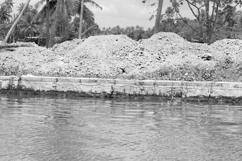
An embankment along a channel of river Pamba being filled up for developing a new settlement in Alappuzha district, Kerala
In Kuttanad human settlements have been created amidst water abundance in different kinds of settings. In the Lower Kuttanad area immediately adjoining the Lake in the south, which lies 1-2 m below mean sea level, a number of human habitations exist as small islands amidst water. Further north, human settlements have been created inside the shallow bed of the Lake itself, commonly referred to as 'Kayal' lands, measuring about 9,500 hectares. North of the Kayal lands lies North Kuttanad which has been formed by natural reclamation of Vembanad Lake due to the silt carried by Meenachil River and its distributaries, and the height varies between 0.5 m below mean sea level to 1 m above mean sea level. In all these three areas, flood risk is high and human settlements have been created in a way so as to adapt to the water abundance and its associated risks in the best possible way. This has been through construction of artificial embankments along the banks of the rivers and their distributaries or in the shallow stretches of Vembanad Lake itself. The human settlements are generally developed by filling the area adjoining an already created embankment with sand, as shown in the above photo. Next, clay retrieved from the lake or river bed may be placed over it, and finally the layers are fixed down by applying pressure until sufficiently hardened. For carrying sand across to such patches amidst water, trucks loaded with sand are often transported on big-sized ferries.
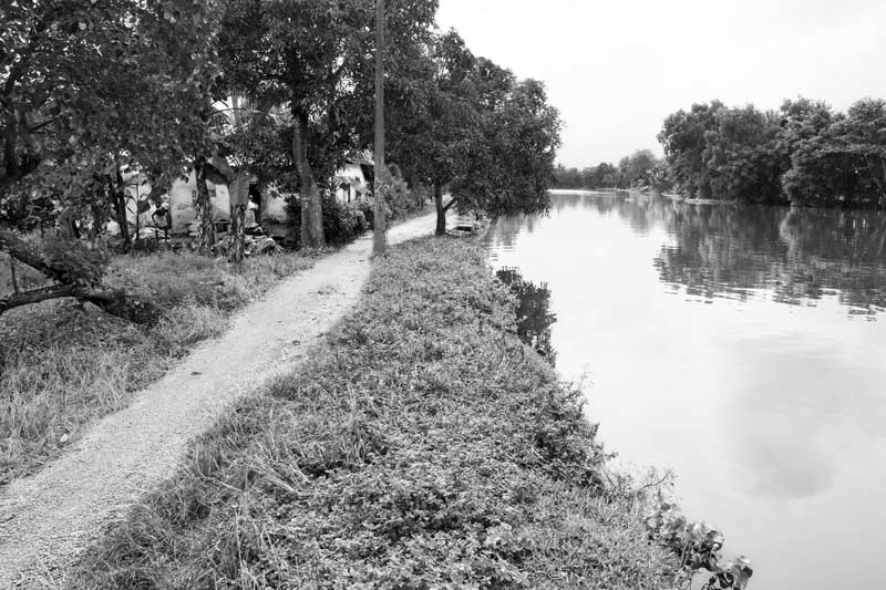
A sandy track for walking along an embankment in Alappuzha district, Kerala
The artificially created human settlements amidst water abundance in Kuttanad are often referred to as 'garden lands' or purayidams, and generally have an elevation of 1-2 m above mean sea level. The landscape of these settlements generally comprises sandy tracks for walking, residential houses, coconut palms, banana plantations and homestead crops. Besides, places of worship such as temples and churches, shops and markets, and even schools, colleges and hospitals may be located on these.
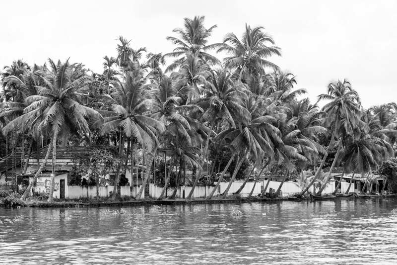
A view of the 'garden lands' – coconut plantation with human settlement along an embankment in Alappuzha district, Kerala
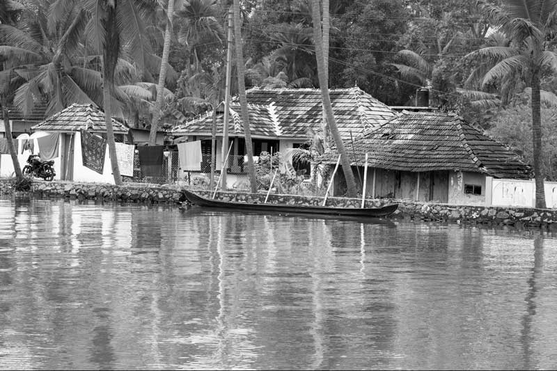
A cluster of houses along an embankment in Alappuzha district, Kerala
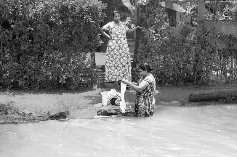
Performing laundry on the banks of a Pamba river channel in Alappuzha district, Kerala
The daily lives of the inhabitants of Kuttanad are deeply interwoven with the water abundance around. The river, canal or the lake serves as the most conveniently available and commonly used water source for domestic purposes. Daily chores such as washing, bathing and cleaning are performed on the sides of the embankments. It is an ordinary sight to find women doing laundry or cleaning dishes at the embankments, making use of the water directly from the river, canal or the lake. Even bathing is often performed at or near the embankment.
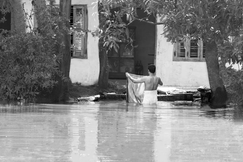
Bathing on the banks of a Pamba river channel in Alappuzha district, Kerala
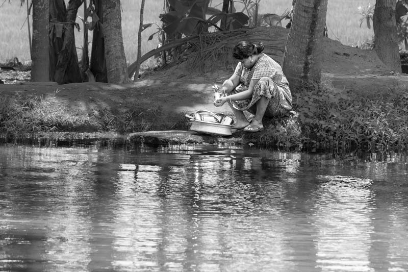
Cleaning utensils along the banks of a channel of Pamba river in Alappuzha district, Kerala
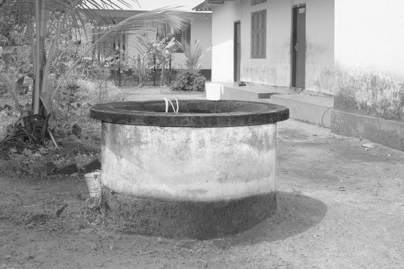
A household drinking water well in Alappuzha district, Kerala
For procuring drinking water in Kuttanad, the surface water bodies located close by have been traditionally utilized such as river, canal or the Lake, or else wells have been dug within household premises, as shown the photo above. Access to groundwater through wells is easy because the water table remains considerably high throughout the year. In recent decades, piped water supply has also been made available particularly in habitations that are a part of or connected to the mainland.
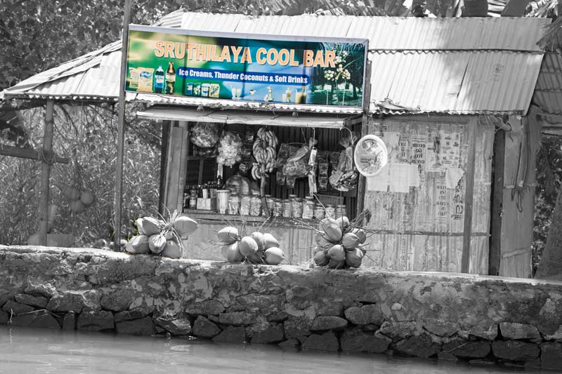
A local kiosk selling eatables, drinks, fruits and tobacco along an embankment in Alappuzha district, Kerala
In the human settlements amidst water abundance in Kuttanad, amenities for fulfilling basic daily needs exist close by. Shops run by local inhabitants provide important provisions. These may be located near the embankments for easy access, as shown in the photo above. For bigger purchases, people travel to markets on the mainland, particularly to nearest towns such as Alappuzha.
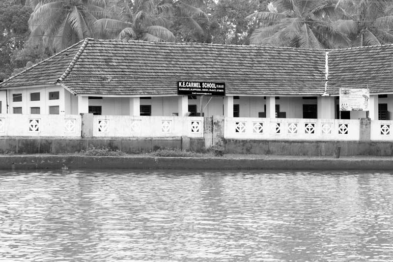
A school located next to an embankment in Alappuzha district, Kerala
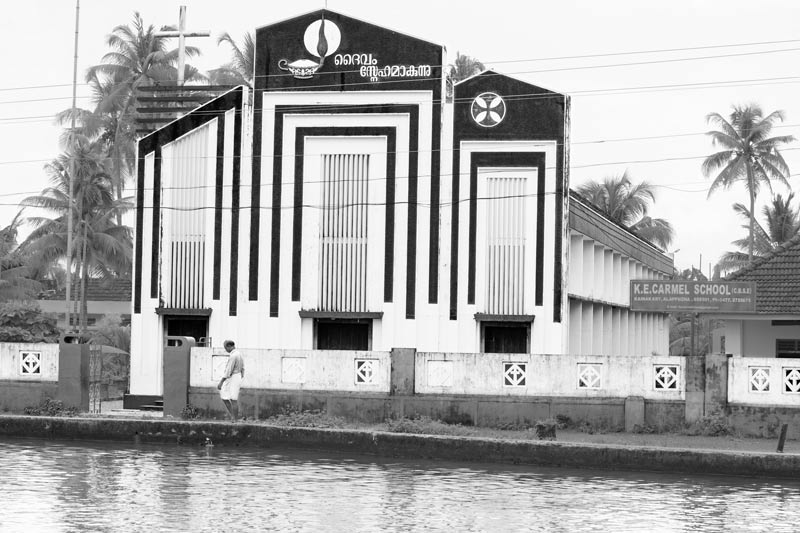
A church located near an embankment in Alappuzha district, Kerala
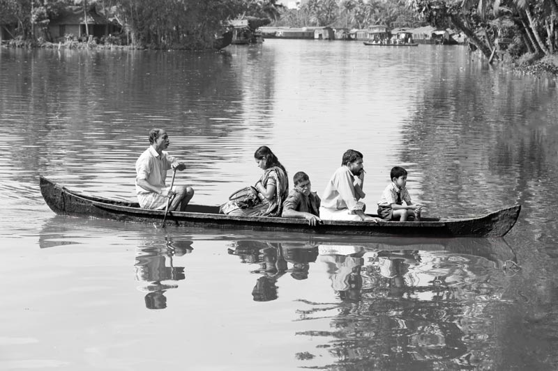
Crossing from one bank of the river channel to another on a local boat in Alappuzha district, Kerala
In Kuttanad where human habitations are interspersed amongst an immense network of waterways and where land connections are few, transportation by water has been developed as the most feasible and naturally enabling mode. Canoes, boats and ferries of various sizes have been innovated to serve various everyday purposes. These are used for local short distance transportation, for example, travelling to school, crossing a canal or river, reaching the market for selling products or buying provisions, visiting churches and temples, and even for transporting building materials. Though most households own a small or big boat, local transportation is also facilitated by boatmen who provide passenger services between important destinations on the banks, as shown in the photo above.
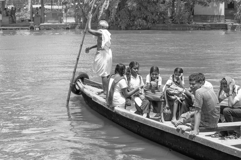
Children travelling to school in the morning on a local boat in Alappuzha district, Kerala
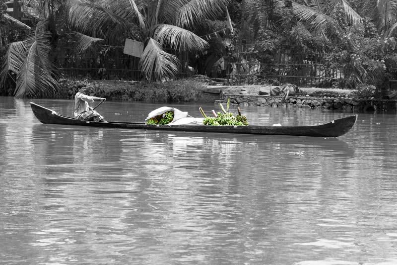
Carrying a fresh harvest of bananas on a canoe for sale in the market in Alappuzha district, Kerala
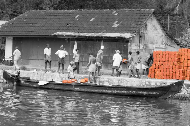
Bricks for construction work being transported by a small motorized boat in Alappuzha district, Kerala
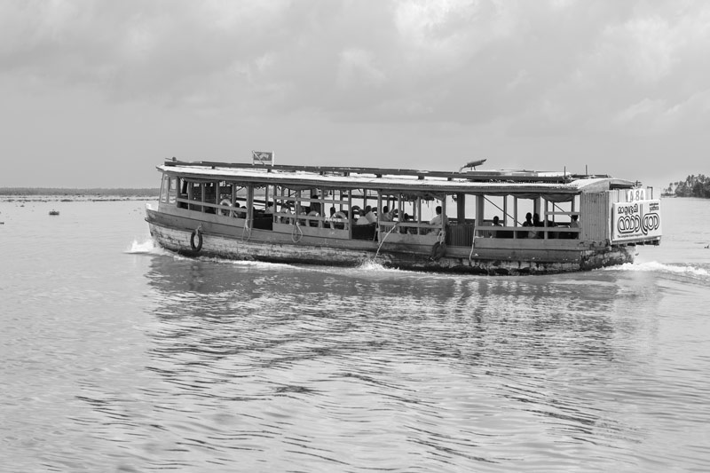
A large motorized ferry carrying passengers on a routine trip in Alappuzha district, Kerala
For long distance transport, such as to the mainland cities, other islands, big markets, etc. ferry service is run by the Kerala State Water Transport Corporation, as shown in the photo above. These ferries can carry 50-150 passengers, connecting important destinations in the region in a manner similar to a bus service. These services are aligned to boat jetties from where people can alight or board. Earlier only conventional type wooden passenger boats were in the fleet, but in recent years, the department has switched over to the use of modern fibreglass/steel passenger boats as well.
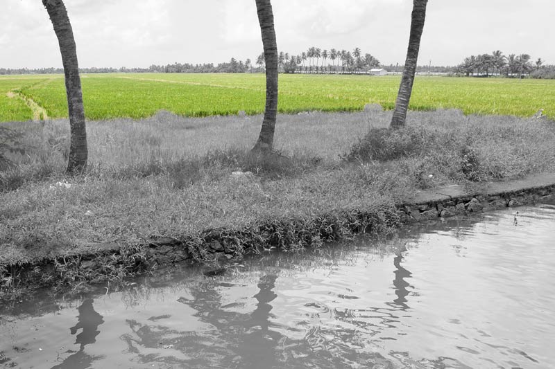
Padshekharam - a block of reclaimed paddy fields next to an embankment in Vembanad Lake in Alappuzha district, Kerala
For livelihood, the people inhabiting Kuttanad have created agricultural fields in the midst of the waterscapes they inhabit, and they have mastered the art of carrying out paddy cultivation below sea level which is now recognized as a 'Globally Important Agricultural Heritage System' by the FAO. They reclaim land from the lake bed or the marshes, converting them into blocks of paddy fields called 'Padshekharam' (or polders), as shown in the photo above. This is made possible by raising embankments with sluices all around for keeping the excess water out of the fields or letting it in when required. The size of these polders can vary between a few hectares to as much as 2,500 hectares. With about 1,350 padsekharams or polders in place, the region extends over 53,600 ha which accounts for 18% of the paddy growing area of the State.
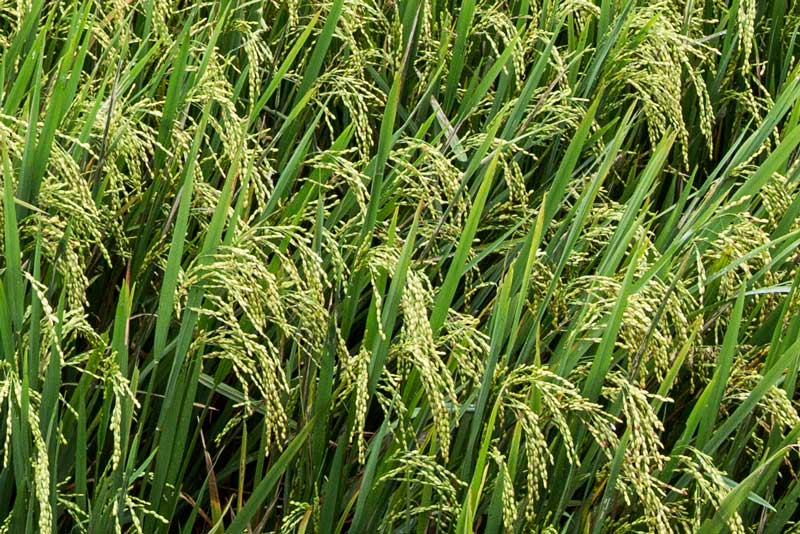
Paddy crop in a padsekharam in Alappuzha district, Kerala
Starting with just one non-monsoon paddy crop (called 'punja') in three years which was grown between the end of the flood season (November) and the onset of dry season (March), today the industrious farmers of Kuttanad grow 2-3 paddy crops every year. They contribute about 25% of the total rice production in the State, bestowing the title of the 'rice bowl of Kerala' to Kuttanad. Rice is a staple food in Kuttanad in particular and Kerala in general.
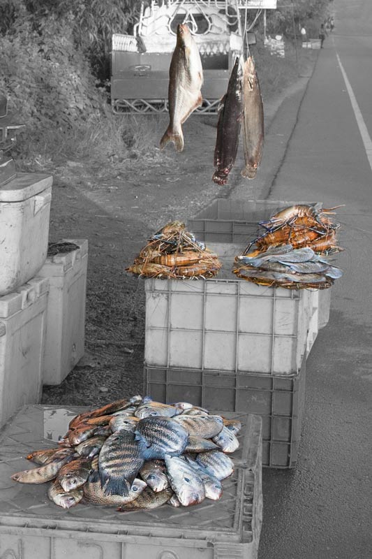
A temporary fish stall on the roadside selling popular varieties like Karimeen, Giant Freshwater Prawn and Walking Catfish in Alappuzha district, Kerala
Given the natural water abundance, Kuttanad is home to several fish varieties, as well as different kinds of prawns and mussels. Thus, fish has come to be adopted as an important part of the traditional diet. In the beginning, there was reliance on fishing in the naturally occurring water bodies such as the rivers, canals and Vembanad Lake, forming an important livelihood activity. In recent decades, taking advantage of the naturally occurring water abundance in paddy fields, fish farming is also being increasingly practiced in the fields as an important economic activity, and several popular varieties caught or produced locally are marketed.
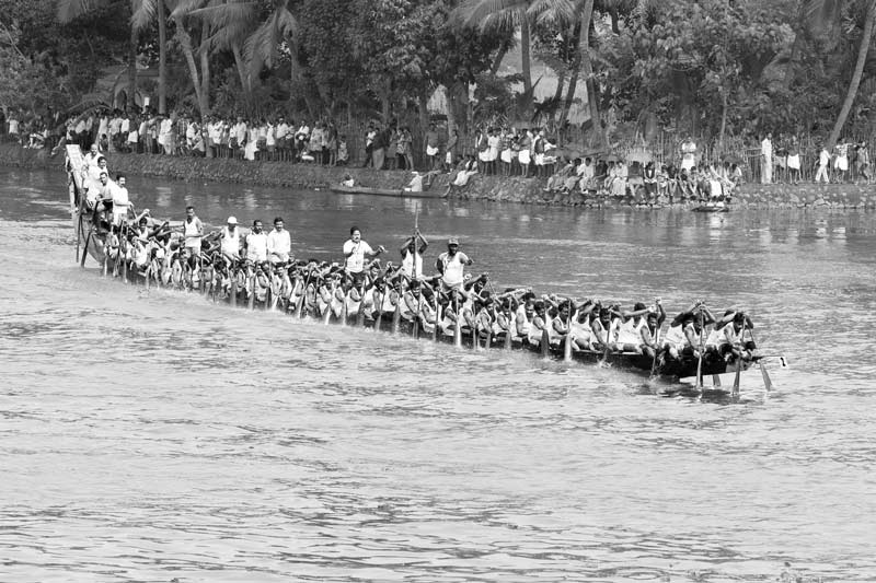
Payippad boat race in progress on Payippad river, a tributary of Achencoil river, in Alappuzha district, Kerala
The intimate human-nature-water relationship extends even to sports, leisure and festivals in Kuttanad. For example, a number of boat races are held in the region every year mainly during the festival of Onam (in August-September) - such as the Payippad, Champakulam and Neerattupuram races. These are not only water sports but also signify festival celebrations, in turn associated with legends connected to famous local temples. Of these, the Payippad Boat Race shown in the photo above, is celebrated as a 'water festival' (Jalotsavam) held for three days in continuity. It is organized by a village called Payippad which lies at the confluence of the rivers Pamba and Achencoil. The race itself is held on the Payippad river which is a tributary of Achencoil. This is perhaps the oldest boat race of Kerala, older than 16th century and associated with a legend connected to the famous Haripad temple.
For centuries, human beings have adapted to a variety of eco-climatic and hydrological contexts. In each context, the adaptation has been based on knowledge of the local ecology, and the resultant risks and opportunities it offers. Technologies rooted in locally available resources have been generally used to conquer the risks and maximize the opportunities. Each case of adaptation has thus resulted in development of a unique set of cultural practices that cuts across various spheres of life including daily living and livelihood strategies. This photo story illustrates how human populations adapt to water abundance by highlighting the human-nature-water relationship in the context of life below the sea level in Kuttanad, Kerala. The ecological setting of Kuttanad where a major part of the region is located below the sea level is what imparts its unique color to the adaptation. The depth of 0.6-2.2 m below the mean sea level in a deltaic floodplain receiving water from four rivers leads to water abundance through a major part of the year, and it is this water abundance that has made possible the specific features characterizing the human adaptation below sea level. The major aspects of this form of adaptation have been: first, the creation of land masses out of waterscapes through the process of raising embankments; second, development of protected habitable pockets for human settlement within these embankments; third, ensuring availability of basic amenities of life within these settlements; fourth, creation of opportunities for sustainable livelihoods amidst water; and fifth, grounding even aspects of life like food habits, leisure, sports and festivals within the water-based culture. It is this unique human-nature-culture complex woven around water abundance that has helped Kuttanad in Kerala earn global recognition for adaptation below sea level. The adaptations mastered by the inhabitants of Kuttanad offer important lessons for adaptation to climate change impacts on water. Their lifestyle offers a useful template for sustainably adapting to sea level rise resulting from global warming, which is already observed as ongoing along the Indian coast at an average rate of 1.6-1.7 mm per year. Several coastal areas along the eastern and western coasts are consequently projected to get submerged in the near future. As explained in the case of Kuttanad, constructing embankments in the areas 'at risk' based on local resources and collective management and practicing lifestyle and livelihood activities that are adjusted to the water abundance around could offer a sustainable way forward to address the risk. This, however, does not imply that Kuttanad's example of colonizing an existing natural wetland should be adopted since this may disturb the ecosystem's sustainability.