Raising Water Consciousness through
World’s Biggest Photo Exhibition and
Largest collection of Photo Stories on Water
Photo Stories | Water and Culture A story based on the theme of World Water Day 2021
The Grand Anicut Complex: History of its development
Nandita Singh and Om Prakash Singh
15 December 2021
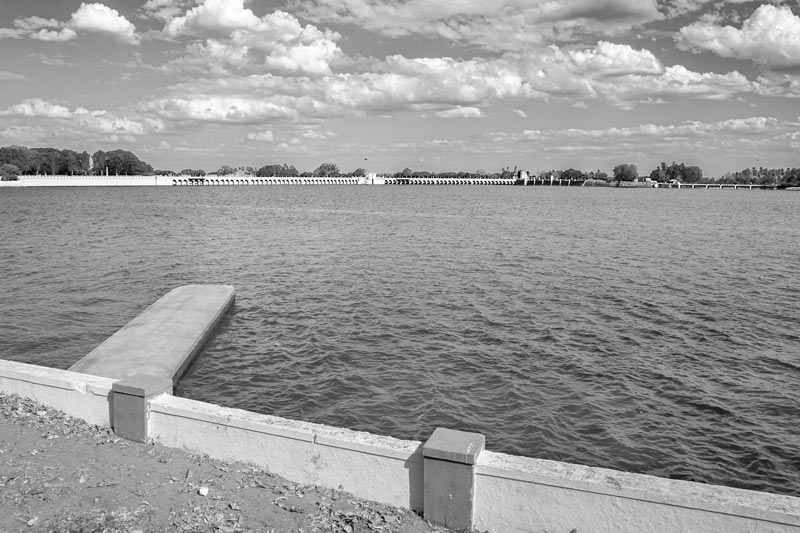
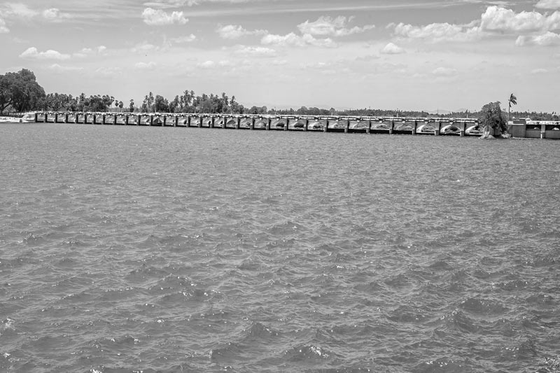
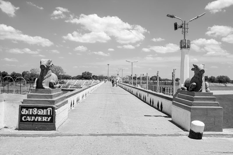
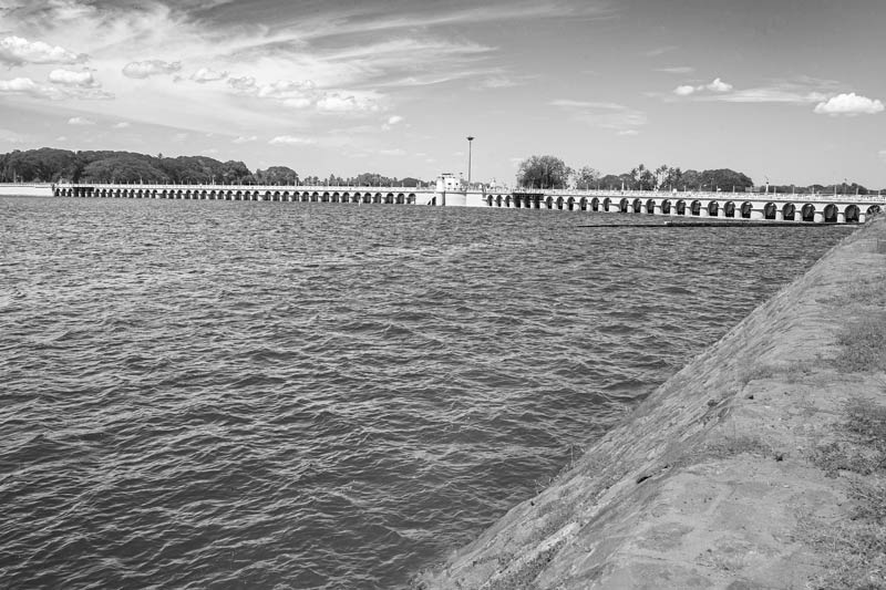
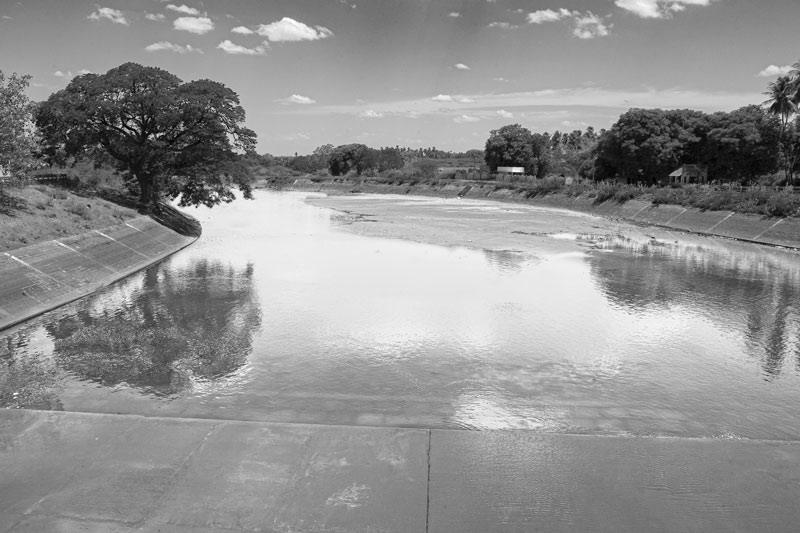
The Grand Anicut, also known as ‘Kallanai’, is considered to be the oldest hydraulic structure in the world that continues to function as efficiently as its modern counterparts. It is dated to the 2nd century A.D., constructed by the great Chola emperor Karikala Cholan, on the left bank of river Kaveri in Tamil Nadu. Kaveri is one of the largest rivers of Peninsular India, and the only perennial river in the state. It is fed primarily by monsoon waters, received twice in the year from the South-West and North-East branches consecutively, the latter being heavier and posing the threat of floods. Grand Anicut was constructed at the head of its nearly flat, fan-shaped delta region across Thanjavur and seven adjoining districts. The purpose of constructing the anicut was two-fold: first, to divert the Kaveri irrigation water to the delta for boosting agriculture through a rich canal network and second, to control floods by passing on the surplus to Kollidam - a distributary of Kaveri that flows towards the north – through the short Ullar channel. The area irrigated by the ancient network of canals emerging from Kaveri and its distributaries was around 69,000 acres (28,000 ha). This enabled the delta to become the "granary of the Peninsular India", with rice as the main crop. Situated in Thogur village, Thanjavur district, about 16 km east of the Tiruchirapalli town, this ancient structure appears to have remained untouched but functional over several centuries. It was in early 19th century that the first modifications in the structure were initiated by the British. They added hydraulic structures upstream and downstream, modified the anicut itself, and even changed the river morphology, leading to development of what is today recognized by many as the Grand Anicut Complex, or even referred loosely as simply the ‘Grand Anicut’. This complex primarily comprises the ancient Grand Anicut (Kallanai) with additional structures, including a block of 5 scouring sluices on its right end; Regulators at the heads of Kaveri and Vennar (the two distributaries arising here from Kaveri’s main channel); and the Regulator at the head of the Grand Anicut Canal. The distributaries Kaveri and Vennar act as the main irrigation canals for the supply of water to the fields in the delta. These rivers, in turn, form a huge network all over the region, distributing the Kaveri waters through 36 natural branches and a distribution network of 29,881 distribution canals with a total length of more than 22,400 km. according to one estimate, out of a total Kaveri delta zone of more than 3.5 million acres (approx. 1.4 million ha), more than 1.3 million acres (535,000 ha) is irrigated through the network originating from the Grand Anicut Complex. This photo story describes the grandeur of this unparalleled cultural heritage of India and unravels how the simple historical Kallanai made of unhewn stones was transformed into the magnificent Grand Anicut Complex that we know today. The title photo presents the beautiful Kaveri waterscape at the Grand Anicut Complex, bordered by the head regulators of Kaveri and Vennar distributaries and as well as that of the Grand Anicut Canal in the background.
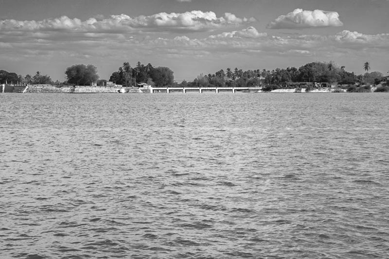
A view of Kaveri River at the Grand Anicut Complex as seen from the Kaveri regulator
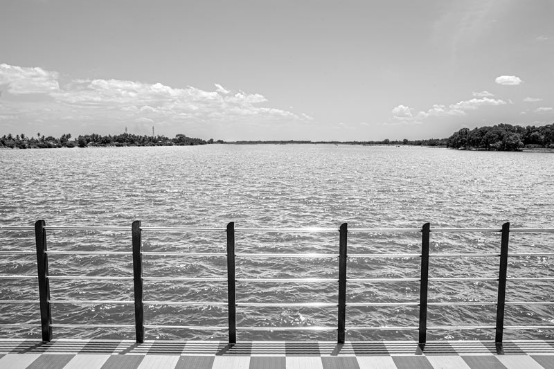
The Kaveri River, also known as Dakshin Ganga or 'Ganga of South', across which the historical Grand Anicut and the Complex has been subsequently constructed, originates in the Western Ghats in Karnataka. It flows for about 800 km, before discharging in the Bay of Bengal at Poompuhar on the coast of Tamil Nadu. In fact, more than half of the river’s stretch lies in this state. Kaveri is one of the seven holy rivers of India and the third largest one – after Godavari and Krishna – in southern India. This river has supported irrigated agriculture in its basin for centuries, serving as the lifeline of ancient kingdoms and modern cities alike. The Kaveri delta is thickly populated, with livelihood supported by a vast network of irrigation channels originating from the Grand Anicut Complex.
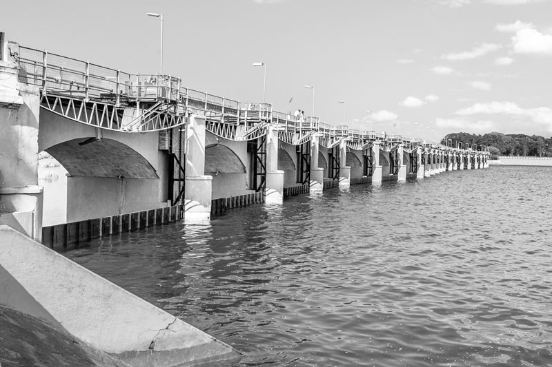
A view of the Grand Anicut Complex showing in sequence, the Vennar and Kaveri Regulators, and the historical Kallanai in the far left
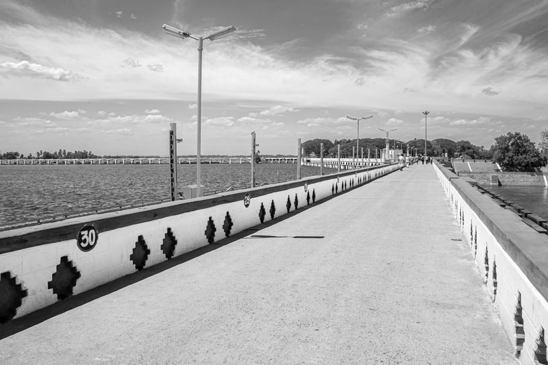
A view of the majestic historical Grand Anicut, along with the bridge constructed over it by the British
The name ‘Grand Anicut’ was bestowed by British engineers in admiration of the magnificence of Kallanai - the simple stone dam on Kaveri. At a point called Mukkombu, located west of Tiruchirappalli town, this river bifurcates into a northern stream called Kollidam and a southern stream that retains the name Kaveri. Further eastwards, Kaveri reconnects with the Kollidam through a short channel called Ullar. At this point of reunion, the bed level of Kollidam is about 3 m lower than that of Kaveri, which means that left as it is, all water would flow into Kollidam. As a result, instead of feeding the delta, it would become directly lost into the ocean. Kallanai was constructed at this point across the Ullar to retain the water in Kaveri and its branches in the delta by raising the water level, allowing passage of only the surplus into Kollidam through Ullar. Kallanai has unique design features, including a serpentine shape, and measures 329 m in length, 12.2 m to 18.3 m in width, and 4.6 m to 5.5 m in height. There exists no recorded information as to how it was founded or constructed. However, it is widely believed that the process involved placement of large cyclopean granite stones across the riverbed. The layers were continuously replenished as the boulders got embedded in the sandy bed by their own weight and thus, the structure slowly emerged out of water.
The bridge over the historical Grand Anicut along with the undersluices controlling the water outflow from Kaveri to Kollidam
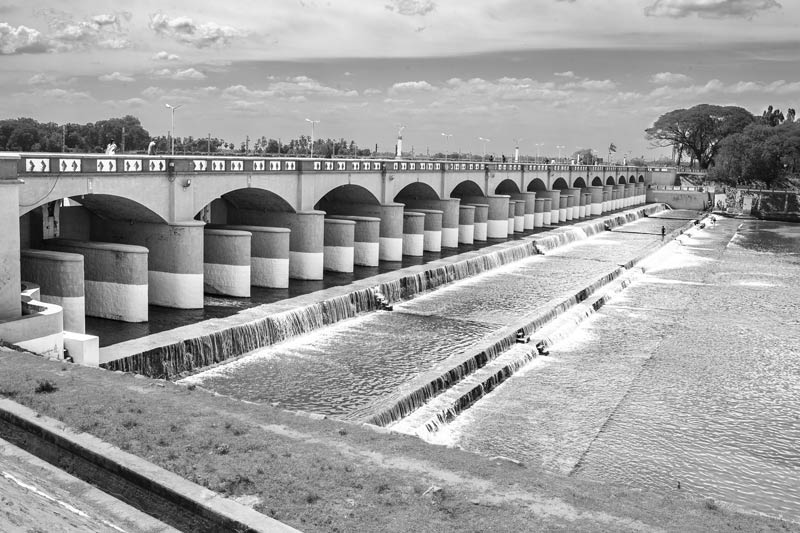
The historical Grand Anicut has been remodeled a number of times during the past 200 years, and very little of the original stone anicut remains today. In 1804, the first recorded modification was made by Captain Coldwell. He repaired the anicut and raised the height of the crest by adding dam stones above. Also, height of the river embankments was raised, thus diverting more water into Kaveri and Vennar. The next alteration was in 1830, when ten undersluices, each measuring 1.22 m x 0.91 m were constructed by Sir Arthur Cotton. In 1839, a bridge consisting of 30 spans of 9.14 m each was built over the anicut, as seen in the photo above. Constructed using the existing work as foundation of bridge piers, the purpose of the bridge was to facilitate operation during floods. However, this reduced the length of the anicut to about 224 m. In 1886, the dam stones were removed and automatic falling shutters measuring 0.86 m in height were fitted on the crest of the anicut. Subsequently in 1899, the falling shutters were removed and replaced by 1.5 m high lift shutters of 9.75 m span in all the 30 arches of the bridge.
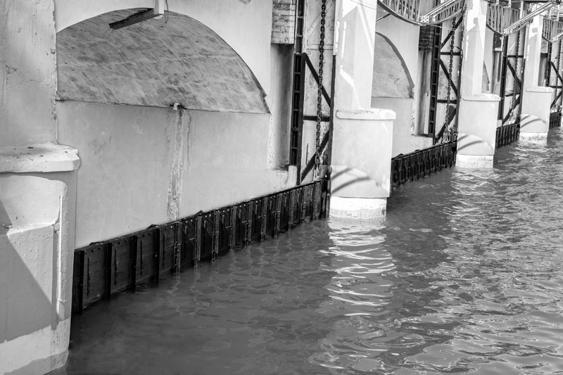
A closer view of the undersluices at the historical Grand Anicut that control the water flow from Kaveri to Kollidam
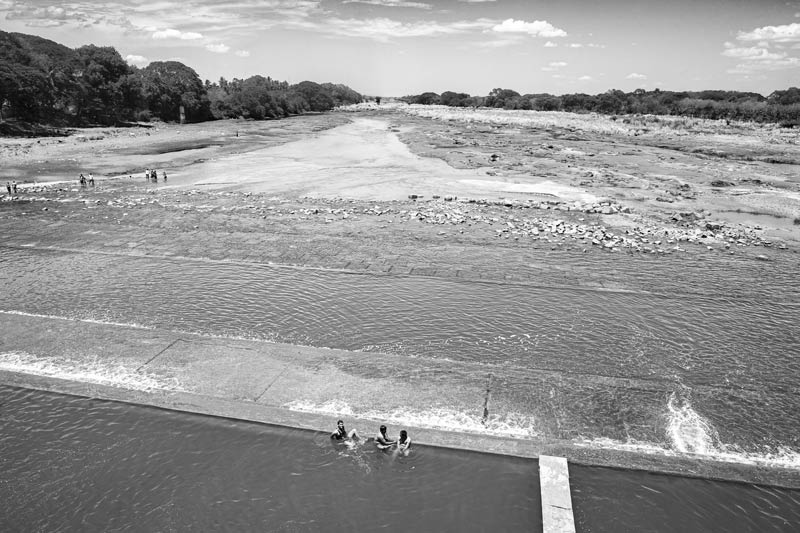
Flood waters coming into Kaveri River during the two monsoon spells drain out across the under sluices at the historical Grand Anicut into Ullar stream, which further passes the water to Kollidam. In fact, Kollidam remains dry during much of the year, and its main role is not irrigation but to receive Kaveri’s flood water, further discharging it into the ocean. This saves the Kaveri delta from floods and enables it to successfully produce two annual rice crops.
The bridge over the historical Grand Anicut, clearly displaying the serpentine shape of the structure
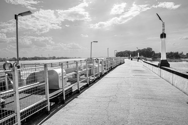
A view of the Grand Anicut Complex seen from top of the scouring vents located next to the historical Kallanai
Between 1925 and 1927 new scouring vents were constructed on the downstream end of the historical Grand Anicut. These were five in number, of 6.10 m span and 3.04 m high, and fitted with radial shutters. Also, to protect the historical Grand Anicut’s foundation from scour, a bed regulator in the form of a 305 m long grade wall was constructed between the anicut and the scouring sluices. The purpose was to redirect the low water course away from the anicut towards the Vennar Regulator and then to the scouring sluices. The scouring vents have a bridge running across that connects these to rest of the structures, thus facilitating operations.
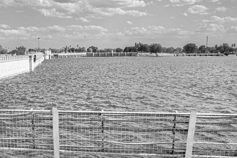
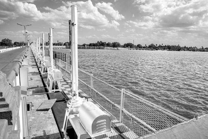
A distant view of the Kaveri and Vennar regulators
The historical Grand Anicut and its later modifications ensured that adequate flows are maintained in Kaveri and Vennar distributaries to enable irrigated agriculture in the delta. However, this could not control large volumes of flood water rushing into these delta streams, thus causing heavy damages. This led to the construction of regulators at the heads of these two distributaries close to Kallanai, completed during the period 1883-1886. These two regulators are situated next to each other, as seen in the photo above. They are positioned at right angles to Kallanai, located about 61 m downstream, and are fitted with ordinary screw gearing shutters. The construction of the regulators caused a change in the original river course, with the Vennar head getting shifted downstream, the original course above subsequently abandoned. The two regulators serve a dual purpose: first, excluding the flood waters from both Kaveri and Vennar, thus minimizing damages on route, and second, at times of normal flow, to help control the distribution of water between both for irrigation.
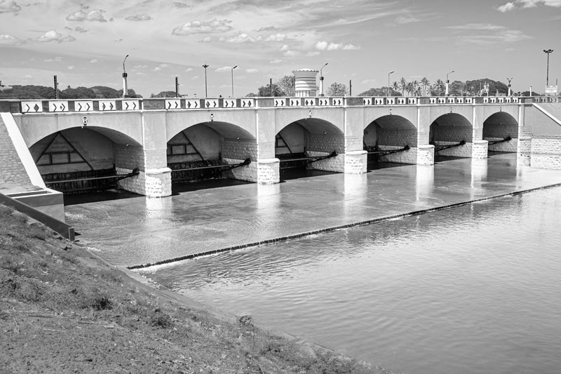
Front view of the Kaveri regulator
The Kaveri Regulator has a total length of 179.5 m, comprising 42 vents, each measuring 3.1 x 2.7 m. The shutters of the regulator are 2.73 m high and the vent way above the top of the shutters has been left open. The regulator allows a maximum supply 441 cu.m./s during floods, while the normal supply is designed at 371 cu.m./s. The vents and the shutters can be seen in the photo above. Water from the Kaveri Regulator is estimated to irrigate an area of about 4.7 lakh acres (1.9 lakh ha).
The bridge across Kaveri regulator
The motorized hoisting mechanism on the front side of Kaveri regulator for shutter control
Rear view of the Kaveri Regulator
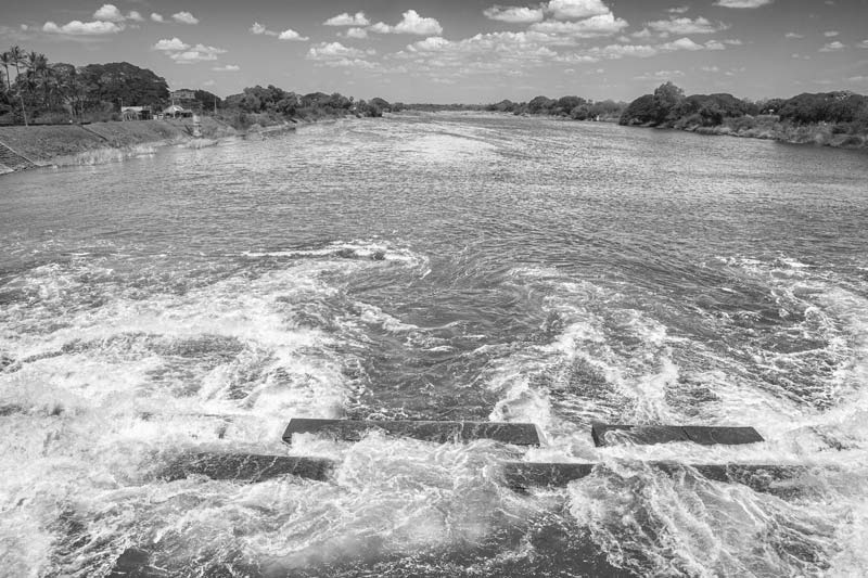
The Kaveri irrigation river flowing out from behind the Kaveri Regulator
At the Grand Anicut Complex, Kaveri River divides into two main irrigation rivers. One of them is called Vennar while the other retains the name Kaveri. Of these, the Kaveri irrigation river is shown in the photo above. Both Kaveri and Vennar further sub-divide into a dense network of waterways, variously referred to as rivers, channels, canals, branches or distributaries and their subdivisions, which together feed the Delta enabling production of a double rice crop. The foundation of this vast Delta network is said to have been laid down by the Chola kings. The channels or canals in the irrigation system are today numbered from ‘A’ for the broadest ones emerging from the river and measuring over 9 m width, through to ‘F’ for those only about 1.5 m wide and running between the fields. According to one estimate, while the Kaveri and Vennar irrigation rivers extend across a total length of more than 1,600 km, ‘A’ class canals in the network extend over 5,500 km, while the ‘B’ to ‘F’ canals jointly extend over a length of about 18,500 km.
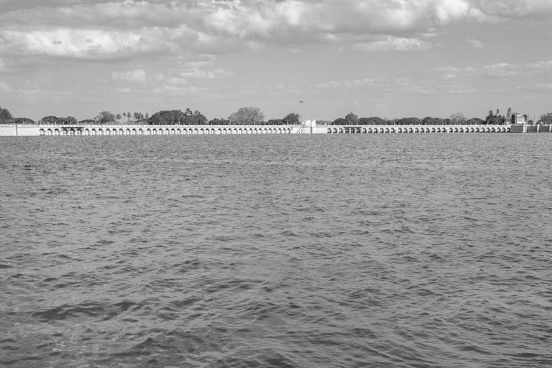
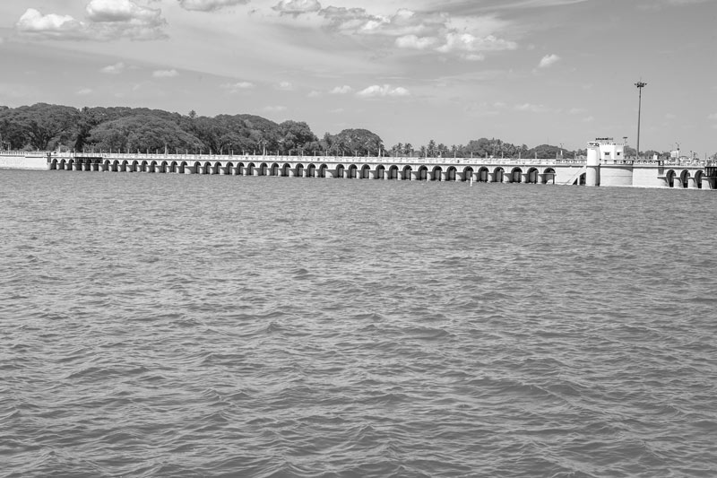
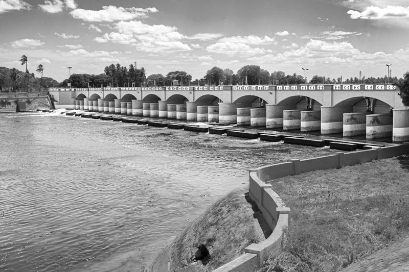
A view of the Grand Anicut Complex showing the fronts of Vennar Regulator on the right and Kaveri Regulator on the left
The Vennar Regulator, seen in the above photo, has a total length of 141.1 m. It comprises 33 vents, each measuring 3.1 x 3.4 m. The shutters of the regulator are 3.45 m high, but the vent over the top of the shutters has been blocked with masonry resting in concrete beam. The regulator allows a maximum supply 377 cu.m./s during floods, while the normal supply is designed at 251 cu.m./s.
Rear view of the Vennar Regulator and River Vennar emerging behind it
River Vennar originates from Kaveri River at the Grand Anicut Complex, as seen in the above photo. This river traverses through Thanjavur, Thiruvarur and Nagapattinam districts and empties into Bay of Bengal by branching off into a number of rivers. It irrigates an area of about 5 lakh acres (approx. 2 lakh ha) in the above three districts.
The Regulator at the head of the Grand Anicut Canal
The Great Anicut Canal was an addendum to the Complex following the construction of Mettur Dam upstream during the period 1928-34 which led to creation of substantial water storage to the tune of 2,645 cubic megametres. This storage was not only an asset to stabilize the existing irrigation in the Kaveri basin downstream, but even enabled the planning of new irrigation area measuring over 3 lakh acres (more than 1.22 lakh ha), situated adjacent to the Kaveri Delta. The Regulator for the Grand Anicut Canal was hence located next to the Cauvery and Vennar Regulators. As can be seen in the above photo, it has six vents, measuring 9.15 m x 1.68 m each and the vents are fitted with radial shutters. Constructed during the period 1929-31, its total length is 66.5 m. The regulator allows a maximum supply 116 cu.m./s during floods, while the normal supply is designed at 99.1 cu.m./s.
A view of the Grand Anicut Canal
When the new structures were designed at the site of the historical Grand Anicut, the river morphology became transformed. The remains of the old Vennar drainage course was diverted for a considerable length to discharge into the Kaveri on the up-stream side of the Grand Anicut Canal through an under-tunnel. This is seen in the above photo above.
This photo story has walked the reader through the history of development of the Grand Anicut (or Kallanai) and its associated hydraulic structures through the centuries. The historical Kallanai was built on the left bank of the river Kaveri about 1,800 years ago in such a way that it maintained higher flow levels in the river for diverting irrigation water to the Delta, while spilling the surplus into Kollidam. It is an unparalleled ancient Indian innovation, bearing testimony to the high level of hydraulic engineering knowledge, skill and vision of the time. It is known to be the best heritage diversion structure in the world, which is still in use to control the water discharges. Together with its water diversion structures, canals, and sluices, it has given a fertile landscape producing rice and other crops spread across thousands of hectares in the Kaveri Delta. The British recognized the value of this hydraulic structure and hence named it the ‘Grand Anicut’. The later developments introduced by the British and improvements in the post-independence era were aimed at further improving the functionality and enhancing the effectiveness of this grand structure. Considering the benefits bestowed by this grand irrigation system, it is no exaggeration to say that the Grand Anicut Complex has come to serve as the lifeline of Kaveri Delta, enhancing food productivity and bringing socio-economic development and prosperity in the delta region. Also, because of its historical value and spectacular architecture, and the beauty and serenity of the place, the Grand Anicut Complex is a prime tourist attraction in Tamil Nadu.
However, over the decades, this great hydraulic structure and the irrigation system supported by it is increasingly failing to deliver the goods. Despite the Grand Anicut Complex in place, farmers in the Kaveri Delta districts, namely, Tiruchirapalli, Thanjavur, Thiruvarur, Nagapattinam and part of Pudukkottai, are facing challenges. On the one hand, the tail end farmers claim to suffer because of the failure to receive adequate water due to damaged sidewalls, bed and irrigation structures. On the other hand, there is reduced water availability in the system itself which affects all farmers in the region. Those very hydraulic structures that were created to enhance water availability for irrigation in the delta have ironically become an important cause of water distress. Siltation of Mettur Dam in the upstream is an important example which reduces the water storage for release in the Grand Anicut Canal. Still another set of problems emanates from reduced sediment flow to the delta due to the numerous dams located in Kaveri and its feeders. As per a 2015 report by the Central Water Commission, sediment flow to the Kaveri Delta has been practically nil of late. Consequences include salinity ingression in the coastal areas which makes even groundwater useless for irrigation in the event of reduced water flow in the irrigation system. Under such circumstances, climate change impacts can cause even greater distress for the farmers, causing loss of livelihood, shortage of water and food, ultimately pushing them to the brink of extreme poverty. This was a recent experience in 2017. Besides, other factors such as changing cropping pattern (with increasing cultivation of water-guzzling crops), industrialization, and urbanization make seasonal water shortages for the delta farmers imminent.
Given these circumstances, it is more than obvious that if the ancient Grand Anicut and the other hydraulic structures in the Complex are to maintain their relevance and stand to fulfil the water needs in the Kaveri Delta, there is an urgent need to holistically understand and address the various challenges confronting them. The promised food production and prosperity of the region can be ensured only when the Grand Anicut and its associated irrigation structures are able to function optimally in distributing the Kaveri waters.