
Raising Water Consciousness through
World’s Biggest Photo Exhibition and
Largest collection of Photo Stories on Water
Photo Stories | Water and EnvironmentA story based on the theme of World Water Day 2020
Impact of Climate Change on the Himalayas: The Story of Gangotri Glacier
Nandita Singh and Om Prakash Singh
22 March, 2020
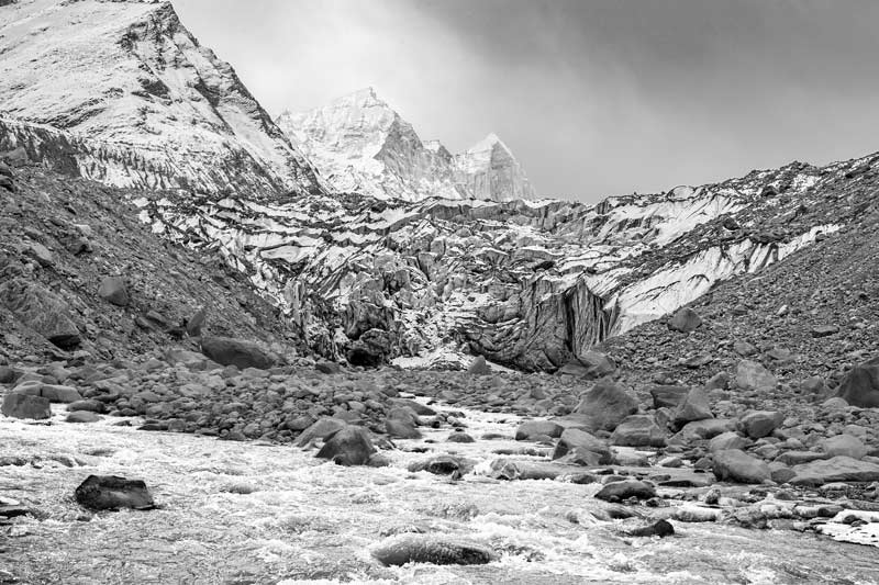
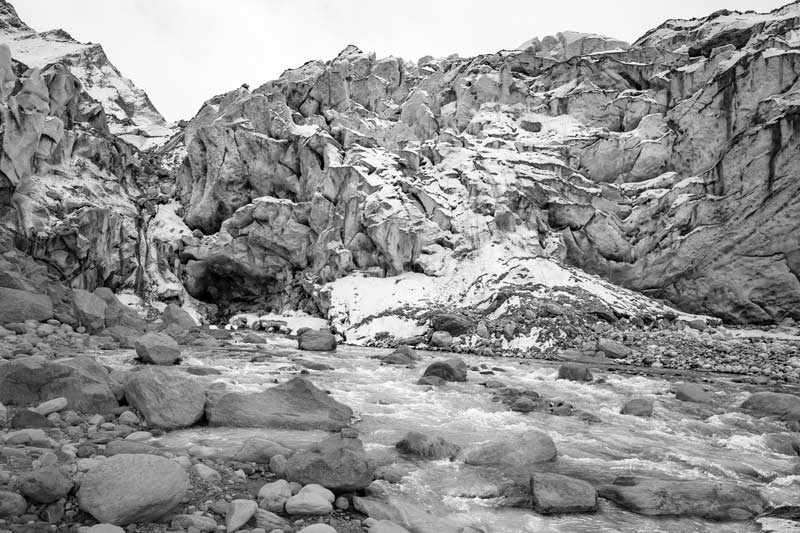
Climate change, defined as a long-term change in the average weather patterns that define local, regional or global climates, is recognized today as the most urgent problem facing humanity. Though the Earth's climate has changed several times throughout history due to natural processes, the persistent anthropogenic changes observed since the 1950s are unprecedented. These are primarily attributed to anthropogenic sources, such as through increasing use of fossil fuel and large-scale landscape changes, that have led to increased emissions of 'greenhouse gases' (GHGs) like carbon-dioxide, methane, nitrous oxide and ozone, in turn leading to a phenomenon commonly referred to as 'global warming'. According to estimates from the Fifth Assessment Report of the Intergovernmental Panel for Climate Change (IPCC) (2014), the average global temperatures have risen by approximately 1°C above pre-industrial levels. This has affected various water-related climatic variables resulting in alterations in the timing and intensity of precipitation, increased risk of drought and floods, rapid sea-level rise, shrinking of ice and snow caps, and retreat of glaciers. These changes, in turn, lead to rampant climate-related risks to livelihoods, food security, water supply, health, human security, and economic growth. The Himalayas - or the 'abode of snow' – is the highest mountain region in the world, with an average elevation of 6000 m. Spanning about 2,500 km from west to east, it is spread across five countries in Asia, with the largest area located in India. The Himalayas is called the 'Water Tower of Asia', being the source of origin of three main river systems: the Ganges, the Brahmaputra and the Indus. The Indian Himalayan region is home to about 51 million people, and over 800 million live in the basins downstream drained by these three rivers. This mountain range is one of the most ecologically sensitive and fragile areas in the world and widely believed to be one of the world's hot spots of climate change. The latest available temperature data here overwhelmingly show a warming trend. Among studies on the Indian side, there are reports of annual average maximum warming ranging between 0.5 °C to 0.9 °C. Even higher warming trends of 1.1-2.5 °C or 1.6 °C have been reported in other studies. Among significant hydrological consequences of the warming noted are variability in precipitation and extreme events, with a downward trend in monsoon and average annual rainfall but increase in pre-monsoon (March–May) precipitation. The Himalayas is said to have the most extensive glacier cover outside Alaska and the Arctic, that releases meltwater particularly during summer and early autumn which feed a number of important rivers and recharge river fed aquifers. According to a detailed study from 2015, the Himalayas taken together with the adjoining Hindu Kush Mountains has 54,252 glaciers. According to a Government of India discussion paper on the Himalayan glaciers (2009), there exist 9,575 glaciers in the Ganges, Brahmaputra and Indus river basins, of which 1,578 lie in the Ganges basin. Of these, the Gangotri glacier – regarded as the source of origin of river Ganges - has been much in the limelight due to its reportedly rapid retreat. The implications of the rapid melting of Gangotri glacier have been debated at length, particularly with regard to wellbeing of the more than 407 million populations residing in the Ganges basin downstream. This photo story aims to unfold the realities of the impact of climate change on the Gangotri glacier, attempting to trace the history and outlining the present status along with the future projections. The title photo presents a view of the Gangotri glacier and the Bhagirathi river flowing out from its snout in Uttarkashi district, Uttarakhand.
A view of the Gangotri glacier in Uttarkashi district, Uttarakhand
Gangotri Glacier is one of the largest Himalayan glaciers in terms of length (30.2 km) and area (143.6 sq.km.). The glacier originates from the Chaukhamba group of peaks, at an altitude of 6,853–7,138 m and flows northwest through the Bhagirathi valley. The mean width of the glacier is about 1.5 km and is estimated to be more than 40 m thick at the snout and more than 300 m thick near its head. The catchment of Gangotri glacier comprises several other big and small glaciers, namely Bhagirath Parvat I, II, III and IV, Chaturangi and its tributaries, Ghanohim, Kirti and its tributaries, Miandi, Swachand and Sumeru. Besides some more associated glaciers in the vicinity directly drain into Bhagirathi - the meltwater stream originating from the snout of Gangotri (called 'Gaumukh'). The latter group of glaciers include Bhrigupanth, Maitri, Manda, Meru, and Raktavarana along with its tributaries. Together all these glaciers are referred to as the 'Gangotri glacier system'. Gangotri and other glaciers in this region are mostly fed by the summer monsoon and partly by winter snow. Western disturbances cause heavy snowfall from December to March over this region. Gangotri glacier, shown in the photo above, is also one of the most sacred shrines in India, with immense religious significance. Since Bhagirathi is regarded as the main source of the river Ganges - the most sacred river for the Hindus – this glacier attracts thousands of pilgrims every year.
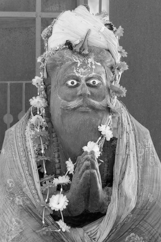
Statue of sage Bhagirath at Gangotri in Uttarkashi district, Uttarakhand
The word 'Bhagirathi' in Sanskrit, implies 'caused by Bhagirath'. According to Hindu mythology, Bhagirath was the grandson of the Suryavanshi King Sagar in ancient India. In order to gain the liberation of the souls of his 60,000 great-uncles from the curse of saint Kapila, he is believed to have meditated in the Himalayas for bringing down goddess Ganga from the heavens to Earth in the form of the river Ganges. The water of river Ganges is believed to have cleansed the ashes of his ancestors, granting them salvation or 'Moksha'. The place where sage Bhagirath performed penance is today venerated as 'Bhagirath Shila' (the Bhagirath rock), marked by his statue, as shown in the photo above. At this spot, located in the town called Gangotri, river Ganges is believed to have descended on Earth. The descent of Ganga is described in Skanda Purana in the words of Bhagirath as: "Then came down from the sky, Ganga the daughter of the snowy mountains, and Mahadev (Lord Shiva) received it (goddess Ganga flowing as a river) on his own head".
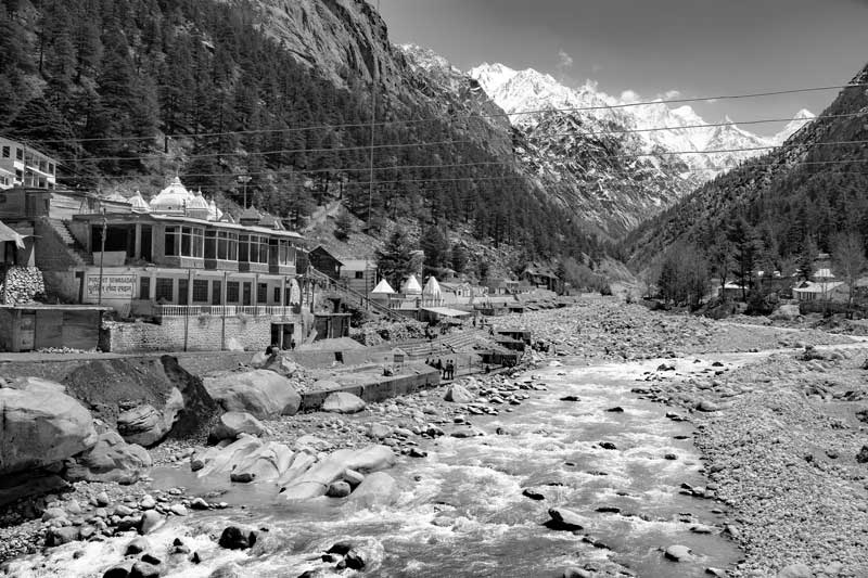
View at Gangotri on the banks of river Bhagirathi in Uttarkashi district, Uttarakhand
Gangotri is a pilgrimage town lying on the banks of river Bhagirathi, at a distance of about 19 km downstream from Gaumukh, and an altitude of 3,100 m. The word Gangotri comprises the words 'Ganga' and 'Utri', which means the descent of the river Ganges, as described above. Here, near the banks of River Bhagirathi, is located the Gangotri temple dedicated to Goddess Ganga. According to a status report on the glacier published by the Government of India (GoI) in 2012, Auden from the Geological Survey of lndia (GSI) had postulated in the 1930s that Gangotri glacier once extended down to Jhala – a village situated about 29 km downstream of Gangotri town, close to Harsil. It has now been confirmed, by dating of the glacier landforms, as published in a GoI status report (2012), that the glacier had indeed extended up to Jhala around 60-23 thousand years BP. Dating further shows that around 17-13 thousand years BP, Gaumukh existed beyond the town of Gangotri to Bhaironghati, approximately 23 km downstream from the present terminus. By around 9-7 thousand years ago, the position of the terminus receded to approximately 3 km upstream of Gangotri.
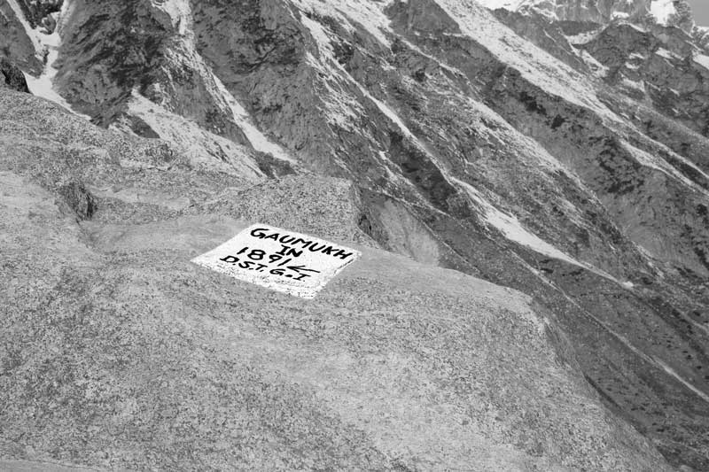
The position of Gaumukh in 1891, indicated by a stone inscription, located about 16 km upstream of Gangotri in Uttarkashi district, Uttarakhand
On the basis of the available evidence, it is obvious that Gangotri glacier has been gradually retreating over the thousands of years of its existence in Bhagirathi valley. It has disappeared through a long expanse of the valley, with some positions along the route being marked through stone inscriptions. In 1866, the glacier and its snout was photographed by Samuel Bourne, and it was much later in 1889-91 that the first sketch of Gaumukh was prepared by Greisbach of GSI. The position of Gaumukh as noted in 1891 has come to be marked on a stone inscription as shown in the above photo. This point is located about 16 km upstream of Gangotri town.
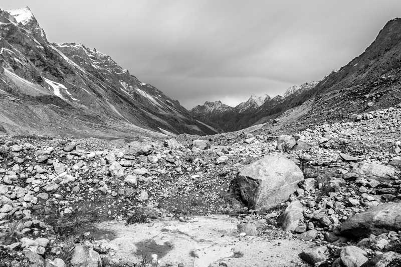
Moraines and other glacial landforms in Bhagirathi valley following recession of Gangotri glacier after 1891 in Uttarkashi district, Uttarakhand
A survey of the Bhagirathi valley vacated by the Gangotri glacier reveals the existence of numerous characteristic glacial landforms like moraines, glacier pavements, saw cut trenches and link cavity system. Presence of these features, as depicted in the photo above, indicates that during several thousand years in the past, the valley was more glacierized than at present. Though the exact rate of recession long back in the past remains unknown, a recession of approximately 1.5 kms is recorded for the period of 44 years between 1891 and 1935. On the basis of various geomorphological features, in the 1930s it was proposed that the rate of retreat of the glacier was 7.35 m per year during the period 1842 to 1935.
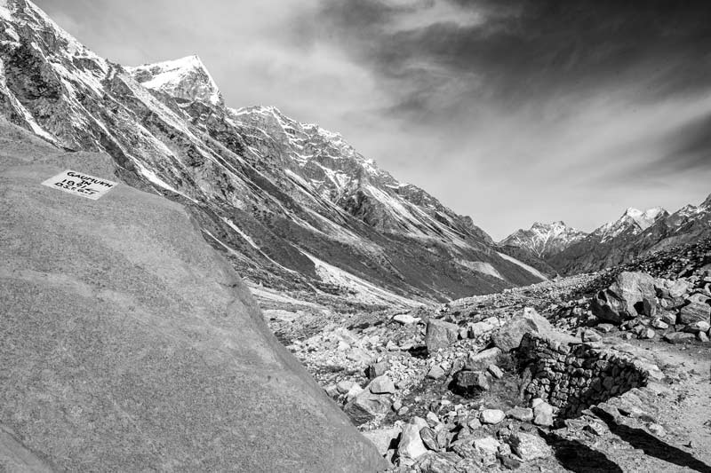
A stone inscription marking the position of Gaumukh in 1935 at about 17.5 km upstream of Gangotri town in Uttarkashi district, Uttarakhand
Moraines left behind by Gangotri following its recession during the period 1935-1966 in Uttarkashi district, Uttarakhand
During a period of 31 years between 1935 and 1966, Gaumukh/Gangotri glacier further retreated by about 1 km and according to figures available for the period between 1935 and 1956, in terms of area, the retreat led to vacation of 2530 sq.m. and this increased by around two and a half times during the period 1956-62.
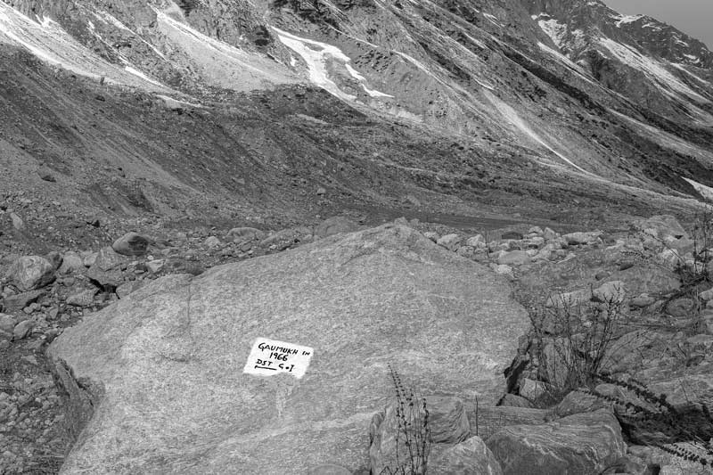
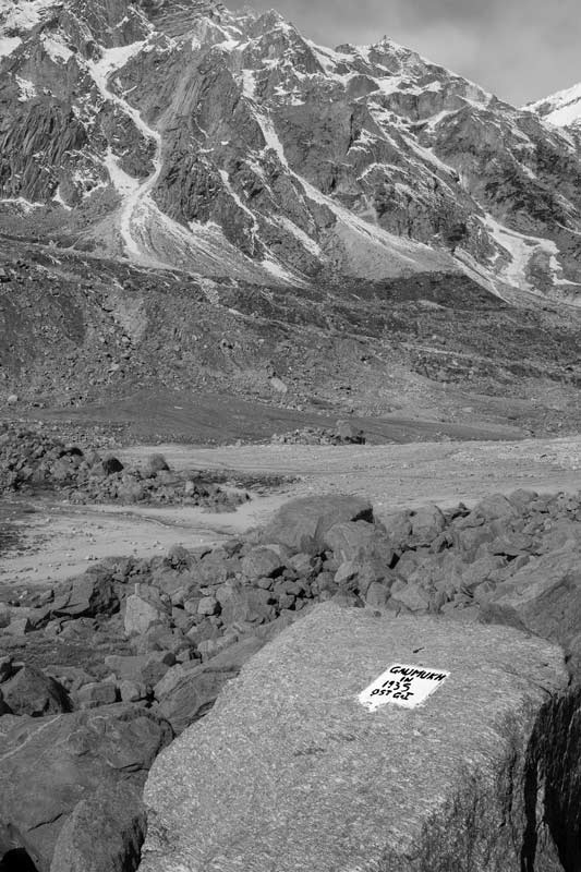
Stone inscription indicating the position of Gaumukh in 1966 at 18.5 km upstream of Gangotri town in Uttarkashi district, Uttarakhand
Moraines in the vacated Bhagirath valley, seen in the direction of Gangotri, resulting from recession of the glacier after 1966 in Uttarkashi district, Uttarakhand
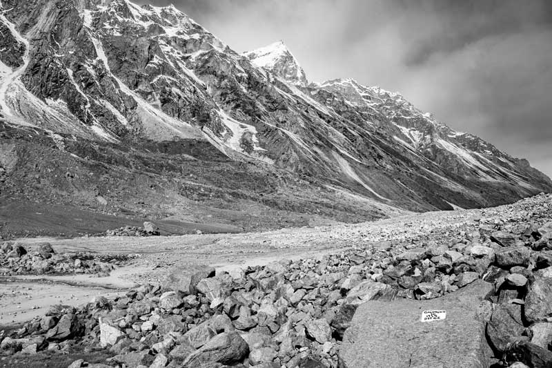
Extensive studies have been carried out in recent years to estimate the rate of recession of Gangotri glacier. The results, however, show much variation due to differences in methodology. According to data published in the GoI status report on Gangotri glacier (2012), between 1962 and 1990 i.e. over a period of 28 years Gaumukh had retreated at 46.4 m per year. According to another estimate (2004), the glacier has retreated by about 1,100 m during the period of 61 years (1935 to 1996), retreating at an average rate of 18 m per year. As a result of continuous recession, Bhagirathi valley has been left covered with extensive till deposits as shown in the photo above.
A view of Bhagirathi valley from where Gaumukh and Gangotri glacier receded in the 1990s in Uttarkashi district, Uttarakhand
As is evident from the above photographic descriptions, including the photo shown above, Gangotri glacier has been continuously receding. Studies on the monitoring of its snout through remote sensing (2012) show that from 1965 to 2006 Gangotri Glacier retreated 819 ± 14 m. The rates of retreat were varied, being 5.9 ± 4.2 m/year from 1965 to 1968, 26.9 ± 1.8 m/year from 1968 to 1980, and 21.0 ± 1.2 m/year between 1980 and 2001. The recession rate declined during 2001–2006, occurring at a rate of 7.0 ± 4.0 m/year. The GoI status report (2012) states that between September 2007 and June 2009 this glacier became practically stand still. Several other studies have been carried out, each of which reports higher or lower figures than that described here. For example, one study (2016) which covered the period from 1965 to 2015 found that the average retreat rate of the Gangotri Glacier during the period 1965–2015 was 19.7 ± 0.6 m per year but declined to 9.0 ± 3.5 m per year during 2006–15. However, there appears to be general agreement among different study findings that the recession rate has been declining since 2000.
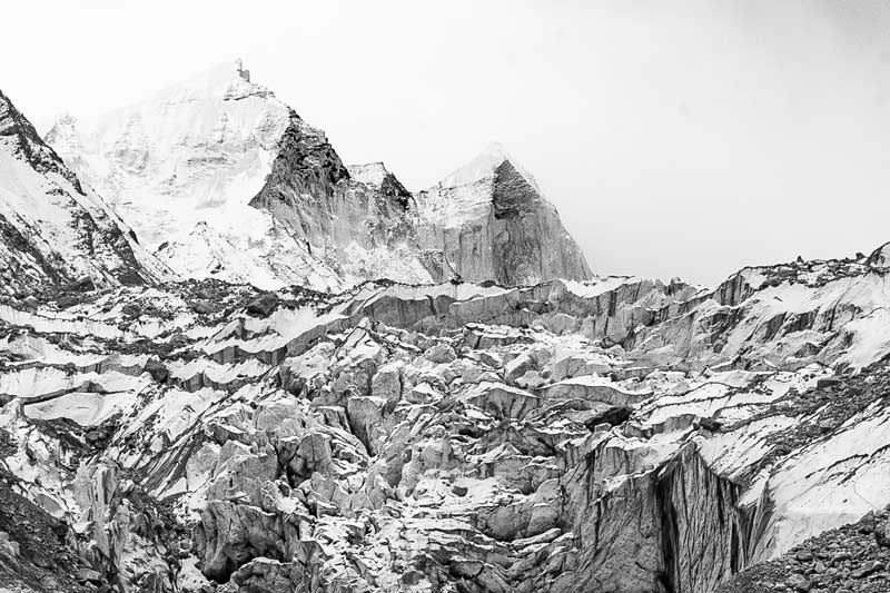
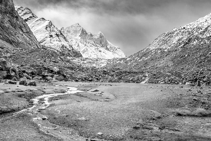
Gaumukh, Gangotri and Bhagirathi group of peaks at the back in Uttarkashi district, Uttarakhand
At present Gangotri glacier exists about 19 km upstream of Gangotri town, its terminus marked by the snout called Gaumukh. A view of the glacier, its snout and the associated glaciers is presented in the photo above.
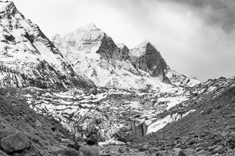
A view of the retreating Gangotri glacier along with Bhagirathi river at Gaumukh in Uttarkashi district, Uttarakhand
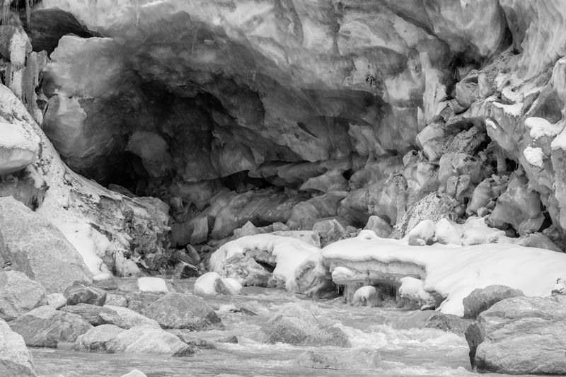
Gaumukh – the snout of Gangotri glacier - and river Bhagirathi emanating from Gangotri glacier in Uttarkashi district, Uttarakhand
The snout or terminus of Gangotri glacier is known as 'Gaumukh', which literally means "Mouth of a Cow", a name attributed by virtue of its shape. Located at an altitude of about 3950 m, Gaumukh consists of a 40 m high ice wall and a large ice cave measuring about 30 m wide and 20 m high. Melt water gushing out of the snout gives rise to the Bhagirathi River, which is the main headwaters of the sacred river Ganges. Maximum melting takes place during the period between May and October. Near the snout front, the Bhagirathi river valley is nearly one kilometer in width. As the source of origin of Ganges, Gaumukh is an important pilgrimage site. Despite its name, the shape of Gaumukh actually varies continuously due to glacier movements and alterations in the environmental conditions. Among the latest changes was that in July 2016, when following heavy rains, a large chunk of the glacier at the terminus collapsed and got washed away, flattening the front of the snout. The photo shown above depicts Gaumukh as it appeared in 2010.
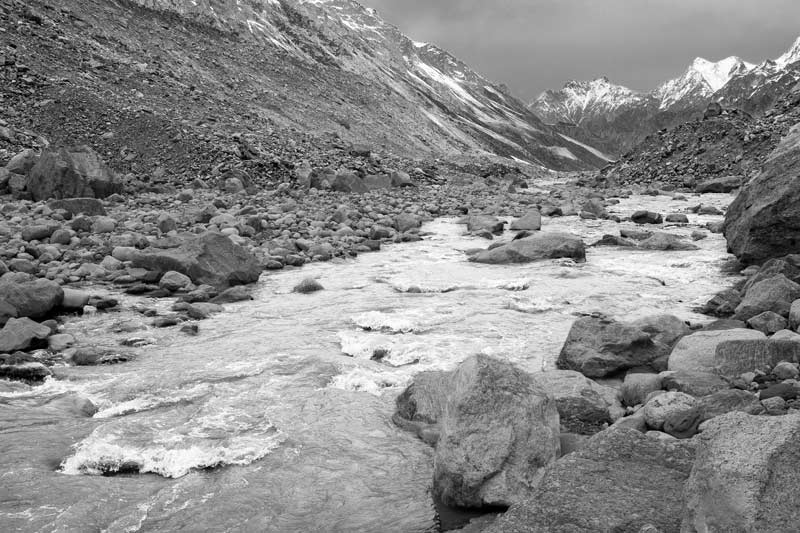
River Bhagirathi near Gaumukh in Uttarkashi district, Uttarakhand
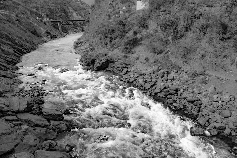
The Bhagirathi river originates at Gaumukh and its basin is fed by 238 glaciers, covering an area of 755 sq.km. Of the various glaciers feeding it, Gangotri is the largest. Bhagirathi is a turbulent river that flows from Gaumukh for 205 km before meeting the Alaknanda River downstream. Though at its point of origin at Gaumukh, the river width is only about one kilometer, along its course, it is joined by several tributaries, namely, Kedar Ganga at Gangotri, Jadh Ganga at Bhaironghati, Kakora Gad and Jalandhari Gad near Harsil, Siyan Gad near Jhala, Asi Ganga near Uttarkashi, and Bhilangna near Old Tehri, enhancing its volume and width.
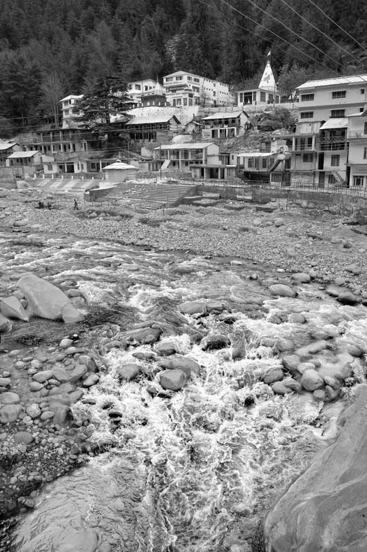
River Bhagirathi flowing past Gangotri in Uttarkashi district, Uttarakhand
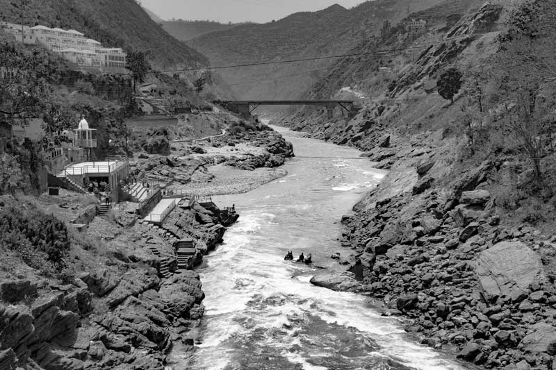
River Bhagirathi is an important source of water for the populations residing along its banks. Gangotri is one of the habitations benefited by its water. In addition, this river also feeds a number of hydropower plants along its course, which serve as sources of drinking water, irrigation water and electricity to a large population living downstream in the plains. Also, due to its turbulence, the river is popular for river rafting. Thus, persistence of Gangotri glacier is important for supporting the life and wellbeing of the dependent populations.
River Bhagirathi at Devaprayag in Tehri Garhwal district, Uttarakhand
Confluence ('sangam') of rivers Bhagirathi, Alaknanda and Saraswati at Devaprayag, Tehri Garhwal district, Uttarakhand
According to Hindu mythology and culture, river Bhagirathi is considered the source stream of river Ganges, and hence venerated. However, in hydrological terms, river Alaknanda is considered as the source stream of Ganges river on account of its greater length and discharge. Bhagirathi river meets Alaknanda at the town of Devaprayag situated at an elevation of 830 m. At Devaprayag, which literally means the 'Godly Confluence', these two rivers also meet the mythological river Saraswati that flows underground. The Alaknanda basin is fed by 407 glaciers, and the river originates at the confluence and foot of the Satopanth and Bhagirath Kharak glaciers in Uttarakhand. Four main tributaries that join with Alaknanda before the confluence with Bhagirathi at Devaprayag are Dhauliganga, Nandakini, Pindar and Mandakini, all rising in the northern mountainous regions of Uttarakhand. After its confluence with Bhagirathi, the river is known as the Ganges. Devaprayag is regarded as one of the five sacred confluences in the Himalayas and an important place of pilgrimage for Hindus.
This photo story has elaborated how the Gangotri glacier in the Himalayas – the source of river Ganges – has responded to changing climatic conditions through the millennia. According to the available evidence, Gaumukh – the snout of the glacier - has receded through approximately 48 km over a time span of about 60,000 years. Obviously, the recession has been a response to atmospheric warming caused by natural processes and has been a consistent slow process. Despite the truth of recession of Gangotri glacier, there exist disagreements and even controversies about the pace of recession and the fate of this glacier in the near future. The Fourth Assessment Report of the IPCC (2007) had stated that "Glaciers in the Himalaya are receding faster than in any other part of the world …..and, if the present rate continues, the likelihood of them disappearing by the year 2035 and perhaps sooner is very high…". Melting of the glacier at an accelerated rate has been projected not only as a concern in terms of disappearance of the Ganges river, but also as posing increased risk of flooding in the mountains and downstream due to release of larger volumes of meltwater with increased temperatures. Such an assessment has led to two opposing views about the impact of climate change on Gangotri glacier. On the one hand is the extreme view outlined in GoI and allied documents (e.g. status report of 2012) according to which assuming a retreat rate of 15 to 18 m a year, it would take almost 2,000 to 1,600 years for the glacier to disappear. On the other hand are those researches that acknowledge the retreat of Gangotri as a reality and seek to find correlation with the changing climatic conditions. According to one of the latest research papers from 2017, the Himalayan glaciers have undergone significant change in terms of their structure and characteristics over the last few decades. These studies regard changes in length, width, volume, and mass change as the most conspicuous signals of global warming, and have demonstrated notable retreat of the snout and depletion of the glacier mass through thinning. Despite this, there appears to be a general tendency to refute the urgency of the matter because glacial behavior is known to be slow. And it is therefore argued that fluctuations exhibited by the Gangotri glacier today is more of response to the climate change stimulus from past than the current anthropogenic pressures. However, as stated before, the Himalayan climate is definitely warming, with significant impact on precipitation and other aspects of the hydrological cycle, which will lead to more pronounced impact on the glacier sooner or later. Glaciers are complex systems and affected by a range of physical and climatic factors, and at present it is not clear whether or to what extent are the observed glacial changes a response to the current anthropogenic climate change. In fact, certain glaciers have even been found to be static or instead even slightly advancing. In relation to Gangotri, recent evidence presented above points out that despite the increasing warming trend, the rate of retreat has decreased during the last two decades. Thus, it may be said that it is rather "premature to make a statement that glaciers in the Himalayas are retreating abnormally because of the global warming".
From these results and discussions, it emerges that in order to understand the impact of climate change in the Himalayas, especially in the context of the glaciers, there is need for conducting more in-depth evidence-based studies. Further, instead of 'blaming everything on climate change', especially considering some of the negative climate change-related hydrological consequences experienced in the Himalayas in recent years such as flash floods and landslides, there is also a need to undertake holistic evaluation of the current environmental transformations undertaken in these mountains. Such transformations include massive deforestation and landscape changes for projects like hydropower development and tourism industry which in turn affect the local microclimate. This will help in protecting the Himalayan environment and climate and help mitigate effect of atmospheric warming for the coming future. These interventions would be important for designing appropriate 'climate action' under Sustainable Development Goal (SDG) 13, in order to enable the Himalayan populations and the dependent masses residing in the river basin downstream to stride towards achieving sustainable development.