Raising Water Consciousness through
World’s Biggest Photo Exhibition and
Largest collection of Photo Stories on Water
Photo Stories | Water and EnvironmentA story based on the theme of World Water Day 2018
Nature for Water: A Tale from the Himalayas
Nandita Singh and Om Prakash Singh
22 March, 2018
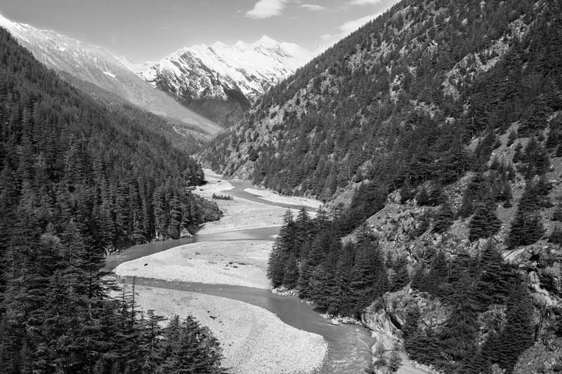
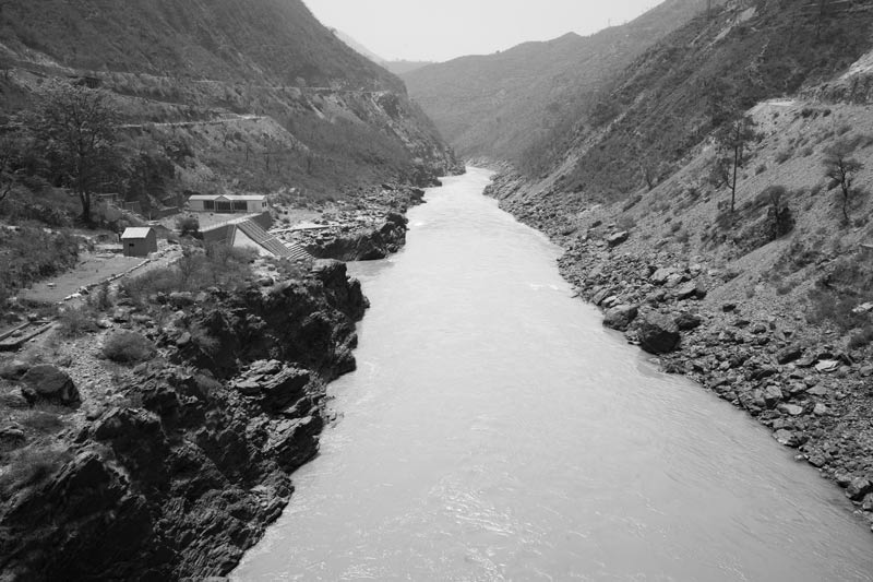
‘Nature’ denotes the entire physical or material world around us, everything that is not human creation. It is commonly taken to include physical aspects like water, air, soil, mountains and valleys; biotic components like forests and animals; astronomical objects like the sun and planets; and even climatic phenomena like wind, clouds and precipitation. Water is a part of nature and is itself nurtured by it. Without nature, there would be no water. Initiated by the Sun’s warmth, and supported by nature’s green cover, nature helps recycle and redistribute water through the ‘water cycle’ that brings precipitation. Plants help in the process by adding to water vapor for cloud formation through evapo-transpiration from leaves. They also help by holding soil moisture which evaporates to add to the water vapor. Also, trees have been found to ‘sweat out’ organic molecules that react with compounds in the air to produce tiny particles that act as ‘cloud condensation nuclei’, thereby enabling cloud formation. Trees further create convection and turbulence in the atmosphere, which can facilitate precipitation. Most importantly, in the present context where global warming affects the water cycle in several ways, forests act as carbon-sinks that can help retard warming of the atmosphere at local as well as global scales. Mountains and hills play an important role in the water cycle by enabling precipitation directly through the orographic process where moist air is lifted along the slopes, making it cool rapidly, in turn causing cloud-formation and ultimately rainfall or snowfall. The water produced in the form of rain and snow eventually feeds glaciers, rivers, lakes and other surface water bodies, also enabling groundwater recharge. Nature also supports water in several other ways. For example, forests and vegetation help build up ‘green water’ storage in the soil which then infiltrates down to recharge groundwater aquifers. The role of nature in nurturing water is multifarious and varies across different kinds of ecosystems. Mountainous ecosystems are an important example that not only play a critical role in the water cycle, but also augment water resources in many ways, that in turn nourish nature and support societal development. This photo story aims to portray these vital relationships in the context of the Himalayas in India. The Himalayas are a 2,400 meters long mountain range spread across five countries of South Asia, with the largest area located in India. These mountains span across twelve states of India, namely, Jammu and Kashmir, Himachal Pradesh, Uttarakhand, Sikkim, West Bengal, Arunachal Pradesh, Assam, Tripura, Manipur, Mizoram, Nagaland and Meghalaya. In the Himalayas lies the source of three great river systems of India, namely, Indus, Ganga and Brahmaputra. In India, the mountain range itself is inhabited by more than 40 million people and the combined drainage basin of the three rivers nurtured by it is home to over 560 million people. This story is about the tale of ‘nature for water’ in the State of Uttarakhand where Ganga - the longest and holiest river of India - originates, and where rich water reserves are contained in several glaciers, lakes, rivers and streams. The title photo depicts river Bhagirathi – one of the headstreams of Ganga – meandering its way through valleys separating the high peaks of the Himalayas in Uttarkashi district, Uttarakhand.
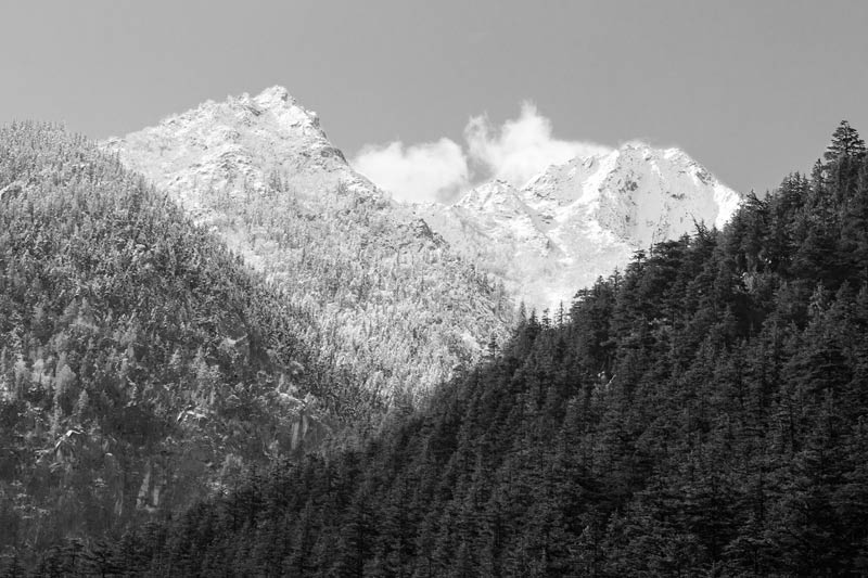
Clouds hanging over the Himalayan ranges in Uttarkashi district, Uttarakhand
The Himalayas play a crucial role in the water cycle in not only India but the South Asian region as a whole. These enable Indian summer monsoon rains by forming a barrier to the moisture-laden winds coming from the south-west. They similarly enable pre-monsoon showers and winter rains from Western disturbances coming from the Mediterranean region. Besides, they also enable locally good rainfall (during monsoon) or snowfall (during winter) by facilitating orographic precipitation where winds laden with moisture from the water bodies in the Himalayas are forced to rise up along the windward side of the mountains, to be rapidly cooled to finally condense as clouds and produce rain or snow. Uttarakhand itself is bestowed with a relatively high average annual rainfall of 2066 mm, bulk of which is received during the monsoon season. Also, its mountain ranges above 1,500 m elevation receive substantial snowfall during the winter months of December-March from the Western disturbances.
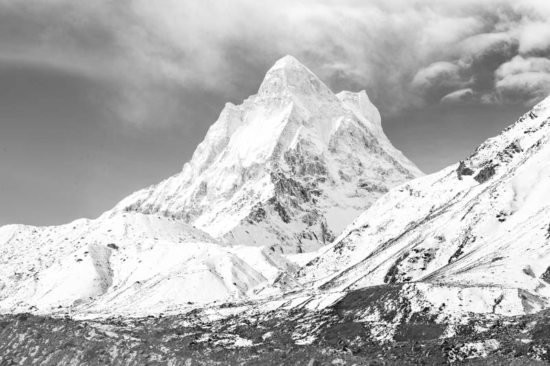
A view of snow-covered Shivling Peak near Gangotri glacier in Uttarkashi district, Uttarakhand
Himalaya means "abode of snow" and after Antarctica and Arctic, the Himalayan range is home to the third-largest deposit of snow and ice on Earth. Its high peaks remain permanently covered with snow and ice and there exist numerous glaciers in these ranges which cover an area of 40,563 sq. km. on the Indian side alone. Shivling, also known as the 'Mahadev Ka Linga', is part of the Gangotri Group of mountains located near the Gangotri glacier in Uttarakhand. It is it is the most revered peak in the group, its name refering to its status as a sacred symbol of the Hindu god Shiva. Though appearing as a single pyramid, Shivling is actually a twin-mountain pinnacle, perched high at an altitude of 6,543 m. It is a steep rock peak, a part of which remains perpetually covered by ice, while another part displays bare rock.
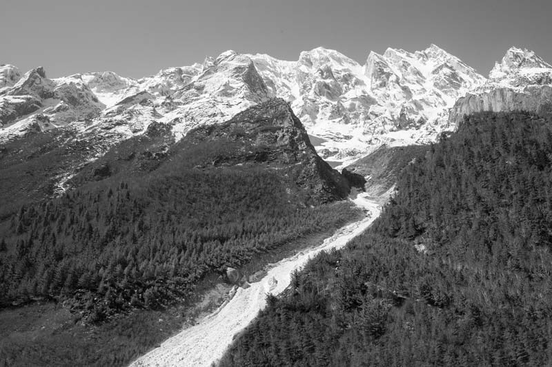
A meltwater stream criss-crossing the Himalayan landscape in Uttarkashi district, Uttarakhand
The Himalayan mountain system is the source of one of the world's largest supplies of water, as all the major rivers of not only India but South Asia originate there. Above the 'snowline' which is beyond 4300–5800 m altitude, the catchments of these rivers remain covered with ice and snow perennially. At the onset of summer this snow starts melting, giving rise to numerous small and big streams that criss-cross the entire landscape, finally enhancing the flow of the bigger Himalayan rivers. In Uttarakhand, near the Gangotri glacier, average daily maximum and minimum summer temperatures have been recorded as 14.7 and 4.1°C respectively, with July as the warmest month, which enables significant melting of the snow and ice reserves, enhancing the volume of river Ganga.
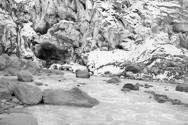
River Bhagirathi emerging from Gangotri glacier at Gaumukh in Uttarkashi district, Uttarakhand
The Himalayas have more than 18,000 glaciers which are the source of the three great river systems of India, namely Ganga, Brahmaputra and Indus, and maintain a regular water supply in them during the dry season. The glaciers are fed by the rain and snow received from the Indian monsoon in the summer and western disturbances in the winter, with maximum snowfall occurring from December to March. Indian part of the Himalayas is home to 16,627 glaciers. Of these, 968 glaciers are located in Uttarakhand, of which Gangotri Glacier is the largest. This glacier extends between 4,120-7,000 meters above sea level, and is about 30 km long and 2-4 km wide. From the mouth of this glacier – called Gaumukh (literally, mouth of the cow), located near the base of Shivling peak – river Bhagirathi emerges, as shown in the above photo. Bhagirathi is one of the major tributaries of river Ganga.
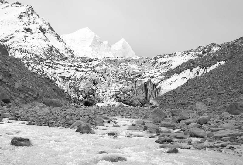
Bhagirathi river near Gangotri glacier with Bhagirathi Group of Peaks in the background in Uttarkashi district, Uttarakhand
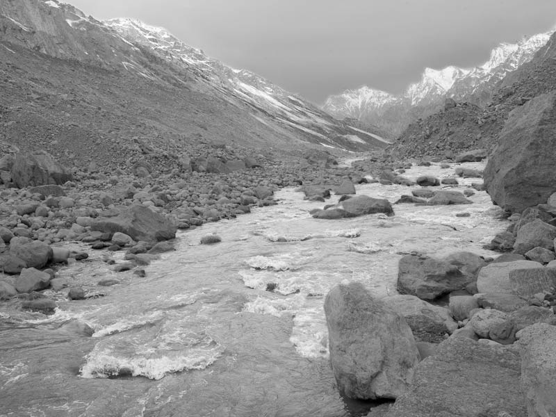
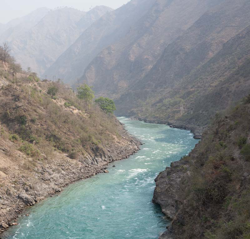
The turbulent river Bhagirathi flowing down its course in the Himalayas in Uttarkashi district, Uttarakhand
The Himalayan range is an intense geographical feature full of steep slopes, nooks and crannies, and deep gorges and valleys, which add turbulence and speed to the water flowing over its surface. Bhagirathi is a turbulent river meandering through the valleys of Himalayas as shown in the above photo. During its course, several other small and big streams join it. Bhagirathi has seven major tributaries, namely, Kedar Ganga, Jadh Ganga, Kakora Gad, Jalandhari Gad, Siyan Gad, Asi Ganga and Bhilangana. During the summer season, meltwater from the mountain snow and frozen glaciers as well as the monsoon run-off add to the river volume, while during the winter, the flow becomes more limited.
Forested Himalayan peaks near Harsil in Uttarkashi district, Uttarakhand
The Himalayan mountain ranges are endowed with a rich forest cover as shown in the photo above. The forests play an important role in the water cycle in the mountains as well as in nurturing the water resources. Up to 1,000 meters altitude, the same kinds of forests are found as in the plains but beyond this mountain vegetation starts, which shows some differences along the gradient from east to west. Uttarakhand lies in the Central Himalayan region where up to 1000 m altitude, Sal (Shorea robusta) dominates. Between 1000 m and 3000 m, different kinds of Oaks, such as Baanj Oak (Quercus leucotrichophora), Tilonj Oak (Q. floribunda), Rianj Oak (Q. lanata), and Karshu Oak (Q. semecarpifolia) dominate. Besides, Bhojpatra birch (Belula ulitis), Chir (Pinus roxburghii), Blue Pine (Pinus wallichiana) and evergreen shrub (Rhododendron campanulatum), is also common at high elevations in this region. The 'treeline', variously also known as 'timberline' or 'forest line', which represents the high-altitude limit of forests determined by low-temperature conditions, lies beyond 3,900 m in the Central Himalayas. Above the treeline, a harsh alpine climate allows only scrub vegetation in the Alpine meadows, locally known as locally known as kharaks or bugyals, beyond which eternal snow begins.
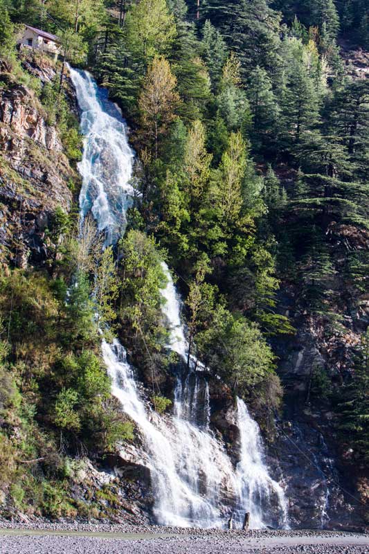
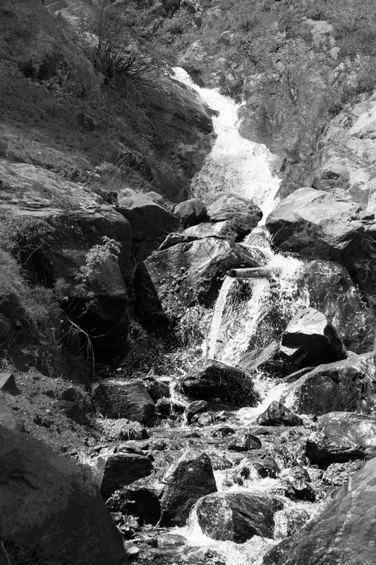
A waterfall meeting river Bhagirathi in Uttarkashi district, Uttarakhand
The Himalayas are criss-crossed by numerous streams and springs, fed by rainfall, seasonal snowmelt or even glacial melt. These help nourish nature, which in turn helps flora and fauna to flourish on the mountains. Sometimes, these form waterfalls on the slopes, as shown in the above photo. Later the water of these streams and springs drains into rivers, adding to their water volume. Due to vegetation and root mats, some part of this water is also captured in the soil as 'green water', helping recharge groundwater. Some of this groundwater further contributes to the river flows along slopes and downstream.
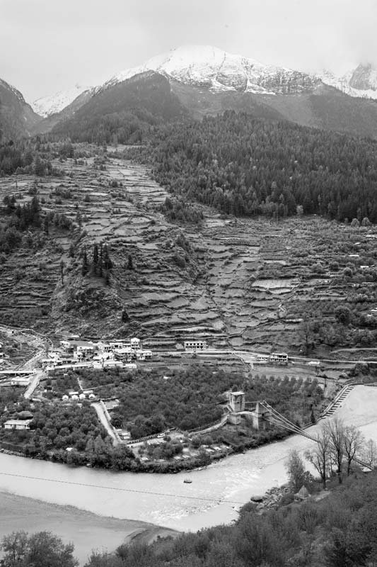
River Bhagirathi at Devaprayag in district Tehri Garhwal, Uttarakhand
When rivers in the Himalayas arise from glacial meltwater, these have small discharges, but during their journey through the mountains, their flow is augmented by surface runoff from snowmelt and rainfall as well as inflow of groundwater, the contributions from each varying during the year. At Gaumukh, the annual discharge of river Bhagirathi is only 1 cu.km. However, at midstream its flow increases to 4.2 cu.km and by the time it reaches Devaprayag (after traversing 205 km) as shown in the above photo, it assumes much larger dimensions, with a flow volume of about 6.3 cu.km. The contribution of glacial meltwater at Devaprayag is only up to 12%, while the major fraction of the flow during the pre-monsoon period comes from surface run off from snow melt and during the post-monsoon from rainfall. The groundwater contribution is estimated to be around 35% during pre-monsoon and 11% during post-monsoon.
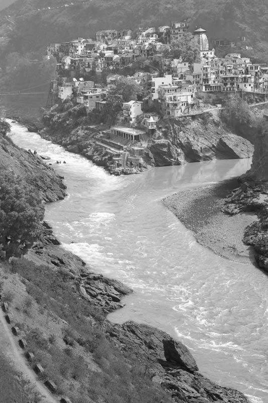
Confluence of rivers Bhagirathi and Alakananda at Devaprayag in district Tehri Garhwal, Uttarakhand
At Devaprayag, literally meaning the 'Godly Confluence', river Bhagirathi meets Alakananda, and the mythological river Saraswati that flows underground. From this confluence the river assumes the name 'Ganga'. The Alaknanda rises at the confluence and feet of the Satopanth and Bhagirath Kharak glaciers in Uttarakhand near the border with Tibet. Devaprayag is regarded as one of the five sacred confluences in the Himalayas and an important place of pilgrimage for Hindus. The confluence is located at an elevation of 830 meters and is surrounded by 3 peaks that are also regarded as sacred, named Giddhanchal Parvat, Dashrathanchal Parvat, and Narsinghanchal Parvat.
River Ganga after confluence of rivers Bhagirathi and Alakananda in district Tehri Garhwal, Uttarakhand
Village Dharali on the banks of river Bhagirathi in district Uttarkashi, Uttarakhand
The different water sources that originate on the Himalayas help nurture human habitations built in the mountains. 11 out of 13 districts of Uttarakhand are mountainous, in which more than 16,000 villages and a good number out of the State's 76 cities and towns are located. Agriculture, horticulture and animal husbandry are common livelihood practices in the villages. Dharali is a picturesque village located close to the town of Harsil. Perched at an altitude of 2,680 m above sea level, it is nestled on the banks of river Bhagirathi, encircled by lofty Deodar and Pine trees. The village is well known for its apple orchards.
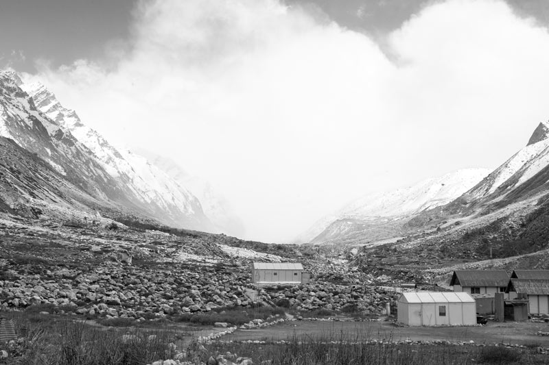
A mountain stream and 'gadera' near Harsil town in district Uttarkashi, Uttarakhand
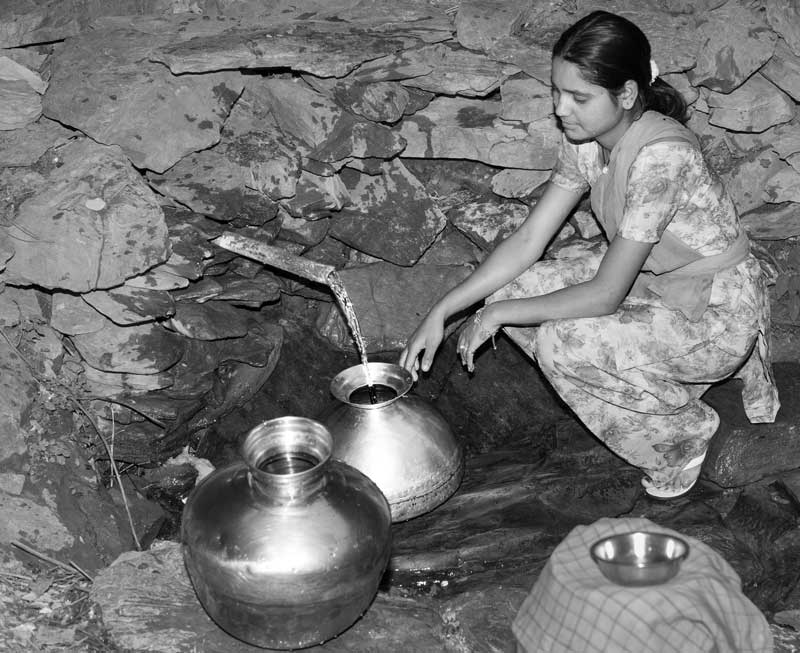
Streams fed by rain and meltwater from the snow and glaciers and springs emerging from fractures and fissures in the rocks nourish the Himalayan ecosystem and also provide water for human use. These supply water to the local hill communities for drinking and other domestic uses as well as for agriculture and other livelihood activities. In order to facilitate water collection from these mountain streams and springs, the water is channelized by fixing a small pipe into the rocky wall behind the water, as shown in the photo above. The resultant structure called 'gadera' is therefore in the form of an unprotected spring from where water can be collected for domestic use.
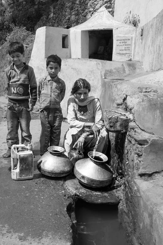
A ‘gadera’ being used as a drinking water source near Devaprayag in district Tehri-Garhwal, Uttarakhand
'Chahal' – a protected spring as drinking water source in district Tehri-Garhwal, Uttarakhand
As noted before, the rainfall received on the mountains helps feed several natural springs that are tapped by local communities for fulfilling their drinking water needs. In many areas, these springs are protected by creating a concrete structure to prevent water pollution from the hill slopes. Further, religious sanctity is often attached to these structures and polluting activities like washing and bathing are prohibited. The resultant structure is called 'chahal' shown in the above photo which not only provides drinking water but the water is reused downstream first for providing drinking water for animals and later for irrigating kitchen gardens.
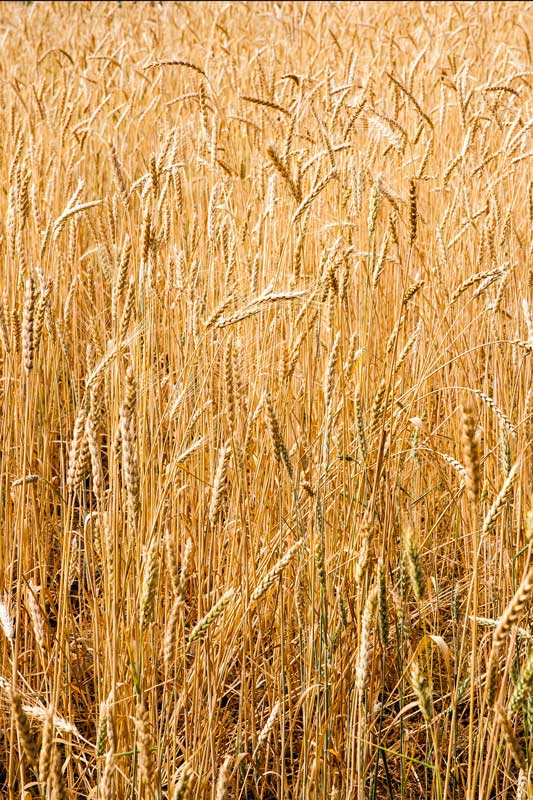
Terrace fields sown with wheat in district Tehri-Garhwal, Uttarakhand
The water nurtured by nature in the Himalayas also enables practice of different livelihoods in the rural communities settled on the mountain slopes. Agriculture, horticulture and animal husbandry are all possible because of the water. The major crops during the kharif (monsoon) season are rice, maize, and pulses while wheat, shown in the above photo, is the major rabi (winter) crop. Besides, horticultural crops including vegetables like potato, tomato, green pea, cauliflower and capsicum and fruits like mango, apple and citrus varieties are also grown on the mountains. Rainfall is the main source of water for agriculture and horticulture, besides the enhanced soil moisture resulting from rains and the underground streams and springs that get recharged by rainwater and snowmelt water. The mountain communities also own good livestock that includes cattle, buffaloes, sheep and goat, which thrive on the pastures nurtured by the available water resources on the Himalayas.
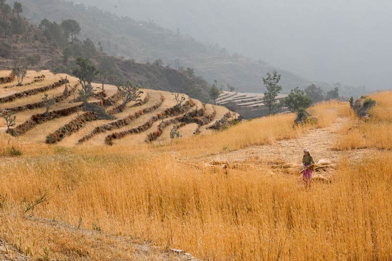
Ripe wheat crop on terraces ready for harvest in district Tehri-Garhwal, Uttarakhand
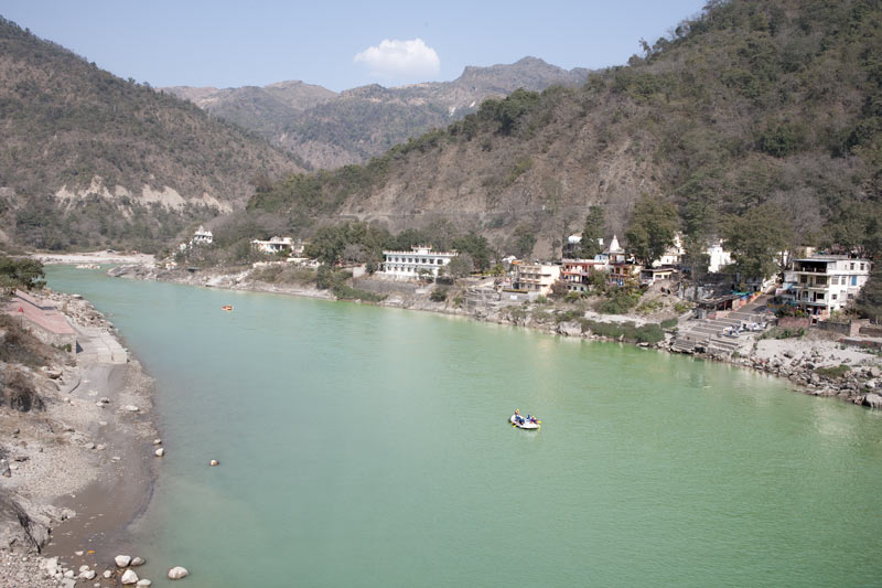
River Ganga at Rishikesh, Uttarakhand
After traversing down the mountains, the rivers originating in the Himalayas enter the plains where they assume even bigger dimensions, by combining with many more tributaries and helping larger populations flourish downstream. At Rishikesh, located at an elevation of 372 metres, river Ganga leaves the Himalayas and flows towards the plains of northern India. The banks of the holy river Ganga at Rishikesh is of great spiritual and religious importance, where saints and sages have meditated since antiquity. Further down in the Plains, this river has served as the cradle of Indian civilization, enabling food production through agriculture, animal husbandry, fisheries, etc., providing channels of transportation connecting people and cultures, and in modern times is an important driver of the socio-economic development in the country.
This photo story has illustrated how nature is important for producing, augmenting and conserving water, which in turn, enables flora and fauna to thrive and human civilization to flourish through the example of the Himalayas in the Indian State of Uttarakhand. It is obvious that nature in general and the Himalayan ecosystem in particular, facilitates the water cycle, which in turn causes precipitation to produce water. The forests present on the Himalayas help augment precipitation directly in a number of ways. These also help the water cycle by contributing to mitigate climate change locally and globally by acting as carbon sink. The Himalayan flora further nurtures water by holding ‘green’ water in the soil, thereby enabling groundwater recharge. This groundwater reappears in the form of numerous mountain streams and springs that criss-cross the landscape, enabling growth of new vegetation, provide food for the animals, and supplying water for drinking and other domestic uses, agriculture and livelihoods in the mountain habitations. These also help augment the water flows in Ganga and other major rivers originating in these mountains that ultimately serve the water needs of the civilization downstream. Over 400 million people are dependent on river Ganga alone for their life, livelihood and development in the plains. The green cover on the Himalayas also slows down the speed of the rapidly flowing water on its surface, preventing landslides on the slopes and flooding downstream, thereby safeguarding human civilization. All these ecological services from nature and water, in turn, offer several possibilities for societal development and enable exercise of basic human rights by the women, men and children living in the mountains and by populations living downstream. Given these intricacies of the relationship between nature, water and human civilization, it thus emerges that if nature would be destroyed, water would become a lost resource, and without water, survival and development of human communities would become impossible. In recent times, several instances of unsustainable use of the Himalayan ecosystem have shown negative impacts on the water cycle, and consequent harm to the local mountain communities as well as those located downstream through droughts, landslides, and floods. It is therefore essential that the delicate relationship between nature and water be understood and respected, and nature be safeguarded and preserved so that the precious water resources derived from nature can be augmented and utilized for the benefit of environment as well as for sustainable development of human societies.